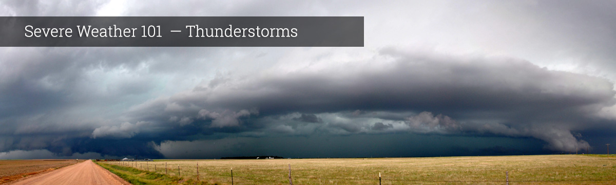
Severe Weather 101
Thunderstorm Detection
Satellites
We can see thunderstorms with a variety of tools. Most areas of Earth can be seen by weather satellites. Satellites take pictures of Earth at regular intervals from space, telling us where clouds are located. Meteorologists watch these pictures over time to watch for rapidly growing clouds, a clue to a possible thunderstorm. Satellites also can tell us the temperature of the clouds. Clouds with cold tops are usually very high up in the atmosphere, and could mean the cloud is tall enough to be a thunderstorm. Meteorologists also track how these clouds move to see what areas will be affected by the storm next.
What we do: NSSL works with partners to develop products from weather satellites that help identify, measure and track storms.
Radars
Weather radar is very important to meteorologists because it can detect rain and severe weather even when it is cloudy or dark.
Doppler radar sends out electromagnetic wave fields that can be reflected back to the radar by things in the air like precipitation. The amount of energy that is reflected back can tell us how heavy the rain might be or tell us there is hail. Doppler radar can also show us how the wind is blowing near and inside the storm. This is helpful in understanding what kinds of hazards the thunderstorm might have (tornado, microburst, gust fronts, etc.) associated with it. It also helps us understand how the thunderstorm is feeding itself.
What we do: NSSL is a world leader in developing weather radar technologies for improved observations, predictions and warnings of high-impact weather including tornadoes, severe thunderstorms and flash floods.
NSSL has developed severe weather warning applications and decision support systems that combine data from radar and other sensors to make the forecasters job easier. The result will be improved NWS warning services for the public, increased detection accuracy, and longer lead times.
NSSL researchers and engineers, in collaboration with the National Weather Service Radar Operations Center, work on radar scanning strategies that provide faster and higher-resolution reflectivity and Doppler velocity data for NWS forecasters. The new scanning strategies lead to earlier detections and warnings of threatening weather conditions.
NSSL is a leader and major contributor to dual-polarization radar technology, installed on NWS WSR-88D radars. Dual-pol identifies debris lofted by tornadoes on the ground, and can tell the difference between different types of precipitation helping forecasters anticipate hail or flooding events. Read more about dual-pol radar→
NSSL researchers are working with an advanced radar technology called “phased array radar” that scans the sky much faster than WSR-88D radars. This technology samples weather more efficiently so forecasters can monitor quickly evolving severe storm and tornado warning situations. Read more about NSSL's phased array radar development→
NSSL's NOAA X-band dual-POL (NOXP) radar is mounted on the bed of a truck so it can be driven up close to different types of thunderstorms to study and monitor them. Read more about mobile radar→
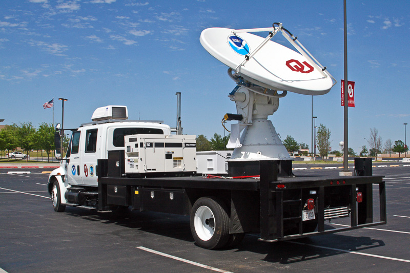
The NO-XP mobile radar [+]