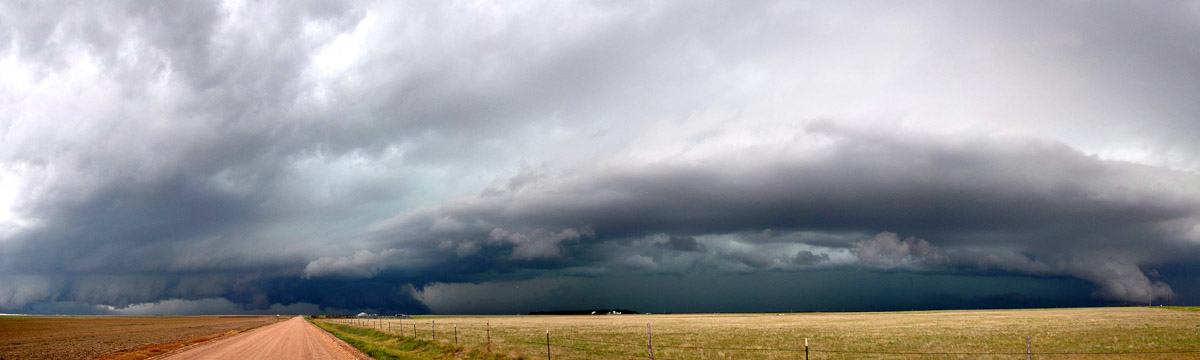
NSSL Research: Thunderstorms
There can be as many as 40,000 thunderstorms each day around the world. They are most common in the U.S., where they can produce tornadoes, floods, lightning and damaging winds. Our mission is to help make forecasts and warnings of thunderstorms more accurate to minimize their impact on our society.
Thunderstorm Research Areas
Thunderstorm Research Partnerships
In the NOAA Hazardous Weather Testbed (HWT), NSSL partners with the NOAA Storm Prediction Center and the National Weather Service (NWS) to develop, test and evaluate severe weather forecast and warning techniques for the entire United States. The cornerstone of the HWT is the Spring Experiment held each year during the active spring severe weather season. The exchange provides forecasters with a first-hand look at the latest research concepts and products, while research scientists gain valuable understanding of the challenges, needs, and constraints of front-line forecasters.
Thunderstorm Behavior
NSSL often participates in field research projects to increase our knowledge about thunderstorm behavior.
NSSL researchers have created a computer model that simulates thunderstorms in 3-D. We use this model to study how a thunderstorm behaves when encountering different weather conditions. This work has led to improved forecasting and warnings, and has increased our understanding of environments that are favorable for the formation of thunderstorms.
A very difficult problem in forecasting is predicting exactly when and where a thunderstorm will form. In our convective initiation project we use computer simulations to study what precursors signal a developing thunderstorm.
Mesoscale Predictability EXperiment (MPEX). NSSL researchers and partners collected data on pre-storm and post-storm environments in an effort to better predict when and where thunderstorms will form.
Thunderstorm Electricity
NSSL researchers study how thunderstorms produce lightning and how lightning is structured by launching instrumented balloons in field projects. They also look at lightning mapping data to see if there are clues showing a storm is becoming more severe.
Thunderstorm Detection
NSSL was a pioneer in dual-polarization radar technology, now installed on NWS radars across the U.S. This capability helps forecasters see evidence of severe weather.
The NOAA National Weather Radar Testbed at NSSL provides a platform for developing and testing a fast-scanning phased array radar. This technology can scan the sky in less than a minute, making it easier to detect rapidly forming severe weather. NSSL is using phased array radar to come up with ways to reduce severe weather false alarms.
Thunderstorm Forecasting
Collaborators on the Warn-on-Forecast project are working to create forecasts of severe weather so specific, forecasters will be able to issue a warning based on that forecast before the weather forms – up to an hour or more in advance. To do this, we are working on techniques to move from the practice of “warn on detection” to “warn on forecast” to extend warning lead times.
NSSL is working on ensemble forecast models for very short-range (0 to 60 minute) forecasts of severe weather events. Ensembles are groups of computer forecast models that are able to ingest Doppler radar, lightning or satellite data of thunderstorms to provide improved predictions of thunderstorms and their associated severe weather. [Real-time data: Convection Allowing Models (CAMs)]
Thunderstorm Decision Support
NSSL continues to work on an automated Multi-radar multi-sensor (MRMS) system that quickly integrates data streams from multiple radars, surface and upper air observations, lightning detection systems, and satellite and forecast models. The MRMS system was developed to produce severe weather and precipitation products for improved decision-making capability within NOAA.
The Four-dimensional Stormcell Investigator (FSI) developed by NSSL and CIMMS (now CIWRO) is now operational in the NWS. FSI allows users to “slice and dice” storms to look at cross sections of radar images. Forecasters have found the tool to be very useful in the warning decision-making process.
NSSL's On-Demand web-based tool helps confirm when and where severe weather occurred by mapping circulations or hail detected by radar on Google Earth satellite images. NWS forecasters can quickly review warnings and check their accuracy with this system. Emergency responders and damage surveyors have also used On-Demand to produce high-resolution street maps of affected areas, so they can more effectively begin rescue and recovery efforts and damage assessments.
NSSL and the National Weather Service collaborate to streamline research into operations. NSSL has developed severe weather warning applications and decision support systems that will make the forecasters job easier. The result will be improved NWS warning services for the public, increased detection accuracy, and longer lead times.
NSSL's Probabilistic Hazard Information (PHI) experiment is assessing the concept of rapidly updating high resolution hazard products that could be customized to meet the needs of specific users. The products would be designed to address their individual response times and exposure to the hazard, versus the current one-size-fits-all approach to severe weather warnings.
Thunderstorm Climatology
An NSSL scientist developed Severe Thunderstorm Climatology to estimate the likelihood of severe weather events such as tornadoes, large hail and damaging thunderstorm winds on a given day in the U.S.
Thunderstorm Preparedness
We are working with social scientists through the Social Science Woven Into Meteorology (SSWIM) program at the University of Oklahoma. Improving severe weather warnings requires social science research to discover how to best deliver timely, usable, and credible information.
Past Thunderstorm Research
Researchers at NSSL and OU/CIMMS developed a storm-targeted radar wind retrieval (STWR) system to provide forecasters with a desired comprehensive analysis tool to accurately analyze and monitor critical low-level wind conditions at very high resolutions.
NSSL researchers, in collaboration with staff of the NWS Radar Operations Center (ROC), developed radar scanning strategies that provide faster and higher-resolution reflectivity and Doppler velocity data for NWS forecasters. These strategies include scanning at lower elevation angles, especially for those radars located on mountain tops, so that the radars can scan closer to the ground where adverse conditions directly affect the public. Overall, the new scanning strategies lead to earlier detections and warnings of threatening weather conditions.