Severe Weather 101
Flood Forecasting
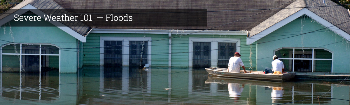
Flash floods represent different forecast and detection challenges because they are not always caused by meteorological phenomena. Flash floods result when favorable meteorologic and hydrologic conditions exist together. Although heavy rainfall is often necessary, a given amount and duration of rainfall may or may not result in a flash flood, depending on the hydrologic characteristics of the watershed where it is raining. Variables include:
- how quickly the storm is moving
- how intense are the rainfall rates
- whether storms are redeveloping and repeatedly impacting the same area (also known as “training echoes,” because the line of storms looks like a line of railroad cars moving over the same area, one after another)
- how much rainfall becomes surface runoff (and where it drains to)
- how porous the soil is and how much water it already holds
- the amount and type of vegetation covering the soil
- how much of the land surface is paved and won't absorb water
- whether there are storm drains to effectively convey water out of the area
- how steep the terrain is
- whether the land has been impacted by recent wildfire
- depth and condition of snowpack
Hydrologists—people who study the effects of water on the earth's surface and in the atmosphere—use instruments to measure the water levels in streams, rivers and lakes. They also measure the water content of snow using snow gauges. They take into account recent precipitation amounts (because soil moisture affects how much rain will soak in and how much will run off), and how much more precipitation meteorologists expect. The data are sent to river forecast centers where computer models are used to predict river and stream levels in their areas of responsibility.
What we do: Coastal and Inland Flooding Observation and Warning (CI-FLOW) is a collaborative prototype real-time system that predicts integrated water level in North Carolina. CI-FLOW captures the complex interaction between rainfall, river flows, waves, tides, and storm surge, and how they will impact ocean and water levels. CI-FLOW is being tested in real-time when coastal storms approach North Carolina. NOAA NWS forecasters have access to CI-FLOW during these events to provide feedback on how well the CI-FLOW system estimates integrated water level. NSSL, with support from the NOAA National Sea Grant leads the unique interdisciplinary team of federal, state, university and private partners.
Forecasters can usually tell in advance when conditions are right for flash floods to occur, but there is often little lead-time for an actual warning. (By contrast, flooding on large rivers can sometimes be predicted days ahead). Scientists are working to understand the types of storms that have high precipitation rates and long duration, and to determine what factors can be used in forecast models and in forecast operations to help forecast floods.
What we do: NSSL developed and implemented a real-time Multi-Radar Multi-Sensor system in 2004, integrating data from multiple radar networks, surface and upper air observations, lightning detection systems, satellite and numerical weather prediction models. The data is used to estimate and forecast precipitation locations, amounts, and types.
MRMS was transitioned into National Weather Service operations at the National Center for Environmental Prediction in 2014 and provides severe weather and precipitation products for improved decision-making capability within NOAA. The operational MRMS QPE products have high resolution and rapid-updating capabilities. The products are also used for verification of satellite rain products and for verification of quantitative rain forecasts from numerical weather prediction models. MRMS serves as a powerful tool for the creation and evaluation of new techniques, strategies and applications to improve QPE. As new concepts are developed, they can be tested within the real-time MRMS environment in the cloud. This process facilitates a rapid science-to-operations transition of new MRMS applications and products for flood and flash flood predictions and water resources management.
The Flooded Locations and Simulated Hydrographs (FLASH) project was launched in early 2012 largely in response to the demonstration and real-time availability of high-resolution, accurate rainfall rate estimates from the Multi-Radar Multi-Sensor project. FLASH introduces a new paradigm in flash flood prediction, using MRMS and producing flash flood forecasts with products generated as frequently as every 2 minutes. FLASH represents the first continental-scale flash flood forecast system in the world, with hydrologic model forecasts being run every 10 minutes. FLASH has almost 11 million grid points across the country improving its forecast. The primary goal of FLASH is to improve accuracy, timing, specificity, and severity levels of flash flood warnings in the U.S., thus saving lives and protecting infrastructure. The FLASH team is comprised of researchers and students who use an interdisciplinary and collaborative approach to achieve the goal. The FLASH system was transitioned to the National Weather Service in November 2016.
In order to evaluate the forecasting tools, scientists need observations of flash flooding. We've assembled flash flood observations from USGS automated discharge measurements, trained spotter reports from the NWS, and from NSSL's Severe Hazards Analysis and Verification Experiment (SHAVE). This database is available for community research purposes.
What we do: The Automated Non-Contact Hydrologic Observations in Rivers (ANCHOR) project leverages remote-sensing solutions for unique hydrometeorological observations. The first component has developed an in-house prototype of a low-power, lightweight, low-cost, scanning LiDAR, which utilizes light rays and remote sensing to measure distance to objects. The LiDAR is used to retrieve a channel’s underwater topography by retrieving the distance from the instrument to the bottom of a stream from bank-to-bank. The second component is a NOAA-funded project that deployed 14 stream radars across the U.S. These sensors report river stage and velocity in real-time. This information can be combined with the topography data to enable direct estimation of a stream’s flow rate. The project represents a change in paradigm in that the sensors are not in contact with the stream, which improves safety and also enables real-time estimates of hydrologic variables without the need for costly measurements in the stream. The system can be readily deployed in a few hours; power is supplied by a small battery charged by a solar panel; the unit can be hung from a bridge or by cables; data are transmitted out by cellular network. All of these emerging technologies use remote sensing to advance the state of knowledge in hydrology.
During the NOAA Hazardous Weather Testbed spring experiment NSSL researchers, in conjunction with partners and colleagues from research, operations and academia, investigate ways to increase flash flood lead times using ensemble stormscale Numerical Weather Prediction products.
What we do: The MRMS Hydrometeorological Testbed Experiment (HMT-Hydro) is an ongoing summer experiment that began in 2014. The in-house experiment provides an opportunity to test out new approaches in flash flood forecasting. For a period of approximately 4 weeks, several National Weather Service forecasters participate during the week by using the experimental products in a real-time setting. They issue experimental flash flood watches and warnings throughout the day, and the research team and the forecasters subjectively evaluate the products the following day. The HMT-Hydro experiment has been successful in garnering essential feedbacks from eventual end-users, thus enabling the researchers to refine and optimize the products. The experiment also provides a rich environment for collaborations and forecaster training.
During the MRMS Hydrometeorological Testbed Experiment, researchers are investigating ways to increase flash flood lead times using ensemble rain forecasts from the Warn-on-Forecast system as inputs to FLASH. This will represent the world’s first coupled atmospheric-hydrologic modeling system that explicitly forecasts the precipitation and concomitant hydrologic response down to minutes at flash flood scale. Another major paradigm change is being explored. Through the use of ensemble precipitation forecasts, researchers are also advancing the FLASH system forecasts from being deterministic to fully probabilistic.