
CI-FLOW
Coastal and Inland Flooding Observation and Warning Project
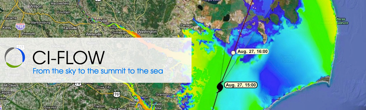
The Coastal and Inland Flooding Observation and Warning (CI-FLOW) project is a demonstration project that predicts the combined effects of coastal and inland floods for coastal North Carolina.
CI-FLOW captures the complex interaction between rainfall, river flows, waves, tides and storm surge, and how they will impact ocean and river water levels.
CI-FLOW is motivated by NOAA’s critical forecast need for detailed water level predictions in coastal areas. Coastal flooding threatens more than half the nation’s population. Storms cause coastal flooding when water from the ocean is driven onto land by wind, tides, waves and storm surge. The severity of these floods can increase when intense rain falls upstream on coastal rivers influenced by tides and surge. CI-FLOW simulates the combined effects of coastal and inland floods.
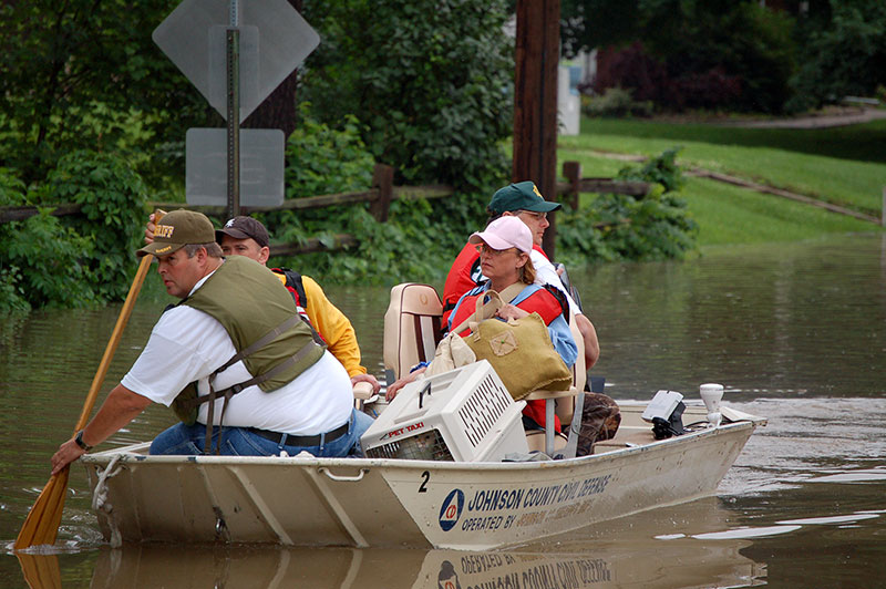
In response to the devastation in North Carolina left by Hurricanes Dennis and Floyd in 1999, a diverse team of national, regional, state and university partners formed CI-FLOW with a united goal to improve integrated water level forecasts. Storm surge and coastal flooding killed 52 people and destroyed 7,000 homes. The area received 20-25 inches of rain over 10 days, causing rivers to crest up to 24 feet above flood stage. The storm surge was measured as high as 13 feet. Additional widespread impacts on the region included livestock and pet evacuations, water pollution from farm animal waste management sites, and backwater flooding due to inadequate bridge design. CI-FLOW focuses on the Tar-Pamlico and Neuse river basins of coastal Carolina and the adjacent coastal waters and shorelines of the Pamlico Sound, the areas hit hardest by the effects of the 1999 hurricanes.
CI-FLOW Fact Sheet — a brief overview of the project, written in layperson's language (.pdf, 1.75 MB, updated 16 Oct 2014)
NOAA nowCOAST
NOAA's nowCOAST is a GIS-based web mapping portal providing integrated, one-stop access to online, real-time coastal environmental observations and NOAA forecasts for any region in the coastal United States. NowCOAST provides users with displays of the latest surface weather and ocean observations, satellite cloud imagery, weather radar reflectivity mosaics, sea surface temperature analyses and gridded forecasts.