
NSSL Podcast
Pod-Sized Science: Studying Tornado Damage With UAS
Text Transcript
[INTRO MUSIC]
EMILY: Hi everybody and welcome to Pod-Sized Science, the podcast about research at the NOAA National Severe Storms Lab. I’m your host, Emily Jeffries.
This is our first podcast, so we’re excited to share it with you. We have a lot of great interviews at the lab as a result of our video series—Bite-Sized Science. Because of its short format, some interview content gets left on the cutting room floor. So, we thought, hey let’s create a supplemental podcast that allows us to take a deeper dive into these topics -- and hear more from the scientists.
If you haven’t checked out the Bite-Sized Science video yet, pause this and check that out first.
Now, without further ado, let’s jump into our first episode.
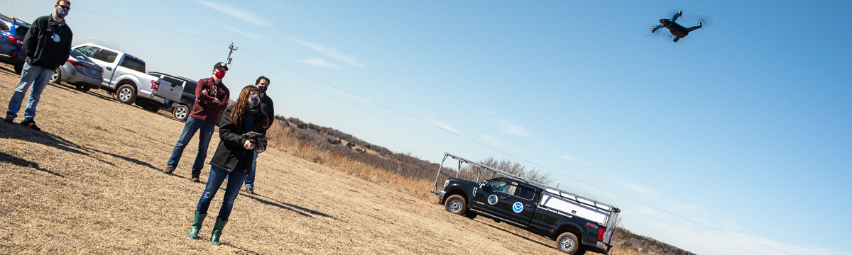
Researchers are studying tornado damage with Uncrewed Aerial Systems, or UAS for short. We interviewed the project's principal investigator, Mike Coniglio, and co-investigator, Melissa Wagner.
Before we discuss this current research, let’s hear a little bit about how they both got involved in working with UAS. Here’s Mike, a Research Meteorologist with the NOAA National Severe Storms Lab. He’s been working at the Lab since 1998, when he started as a student employee.
MIKE: So I've studied severe weather for a long time here at NOAA NSSL, but it's mostly been with the atmospheric properties of storms. And I really haven't focused much on the aftermath of the storms and in the two decades that I've been doing this research, one of the areas that I've seen that we lack some knowledge and is understanding how strong storms really are and what exactly happened when a tornado or a high wind event impacts a rural area… So I hope to be able to develop a better database for tornadoes that we can then go back and understand the dynamics of storms better based on better estimates of what actually happened with events over rural areas.
EMILY: And here’s Melissa, who began working as a Postdoctoral Research Associate for the University of Oklahoma’s Cooperative Institute for Mesoscale Meteorological Studies with NOAA NSSL in 2020. Prior to Norman, she was a grad student in Geography at Arizona State University.
MELISSA: So I got involved with UAS Systems particularly when I was working on my Masters thesis. I was doing satellite based damage assessments and I had noticed that there were some limitations and be able to detect the damage and I felt that using UAS would be a great and innovative way to be able to address some of those limitations.
EMILY: So how does UAS fit in with other tools like radar and satellite for observing tornado damage? Mike provides more insight.
MIKE: Newer radar technology is very good at detecting debris that tornadoes loft into the air But we can't tell exactly where that tornado occurs or how strong it was from that information and also the radar might not be able to see it if the tornado occurs far from the radar. And satellites also collect imagery of damage, but the images are far coarser than what we can obtain from cameras on our UAS, and also we have issues with obtaining the imagery in a timely manner because of clouds and flexibility issues with the satellites. So UASes give us a very flexible option to get out and obtain imagery in a timely manner and obtain very high resolution imagery of the damage that tornadoes produce.
EMILY: The scientists talk a lot about storm intensity and the importance of assigning accurate ratings.
MIKE: We want to use UASes to study storm intensity because it's very difficult for the Weather Service to assign intensities to tornadoes in rural areas where there may be very few structures that were hit or very few damage indicators to go by with our current rating techniques. So we want to be able to provide some research that can help provide guidance to them to understand how to rate tornadoes in these rural areas where maybe only vegetation was impacted.
EMILY: A key tool is the multispectral camera on the fixed-wing aircraft. Melissa explains why this camera is so important for studying damage to vegetation.
MELISSA: So the multi-spectral camera that we use on the UAS provides us very high resolution imagery, so we're talking about something that's about 8 centimeters scale. If you're flying up 400 feet. This camera also has multiple bands, so it collects visible imagery is what we see as a true color, but then it also collects near infrared information and as well as red edge information, so near infrared and red edge are really important because they help us to assess vegetation health. So by looking at the response of vegetation in those two bands we’re able to determine what has been damaged. And what has not been damaged? So that really provides very high detailed information to help us really be able to better understand damage to vegetation.
EMILY: This research is being done in the southeastern United States. The team has traveled to states like Alabama and Louisiana. So why that region?
MELISSA: It's really important to focus our research in the Southeast US because they tend to have a lot of nocturnal tornadoes, so tornadoes that happen at night. And because because these tornadoes happen while people are sleeping, they can be more deadly, so there's a greater loss of life with these events as well, as there's also a more vulnerable housing stock affecting fatalities in this area, so it's really important that we focus on a better understanding of tornadoes in this area.
EMILY: The researchers plan to study more storm events in the future with UASes. They describe the scope of this project and what they’ve learned so far.
MELISSA: So this project is a two year project and what we hope to accomplish is to be able to better characterize damage to vegetation. So have a better understanding of the potential of storm intensity. And really by using additional datasets such as radar or other observational datasets we would like to get a better understanding of what's going on in terms of storm dynamics, 'cause there's still a lot of discoveries that are yet to be made in terms of understanding damage, and understanding how landcover can influence damage patterns.
MIKE: We have learned that using a fixed wing UAS is essential for being able to cover a lot of ground very quickly in a timely manner after an event occurs, compared to a standard quadcopter UAS technology, because we can get a lot more battery time, a lot more flight time out of it. Which is important because people tend to go out and clean up quickly after an event. So we want to be able to cover as much area as we can for our research.
EMILY: Thank you for tuning into Pod-Sized Science and thank you Melissa and Mike! To learn more about this project and other research at the lab, stop by nssl.noaa.gov and follow us on social media.
[OUTRO MUSIC]