INTRODUCTION
Storm D began to form in the late evening, roughly 30 miles south of those areas that had just been hit by the Oklahoma City Supercell. Storm D went on to produce four tornadoes of its own, each with fairly lengthy tracks. The fourth of these directly struck the shopping mall located along I-44 inbetween Oklahama City and Tulsa. F3 damage occurred.
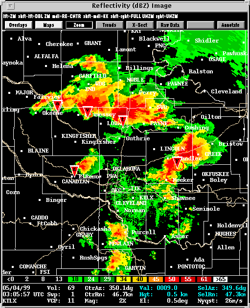
Warnings were issued well in advance, but the severe weather situation certainly was challenging. By (03:05) there were five dangerous storms in Central Oklahoma. At this time, WDSS played a somewhat increased role in the warning process through its ability to summarize the intensity of many storms.
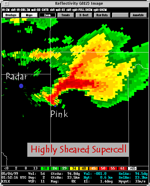
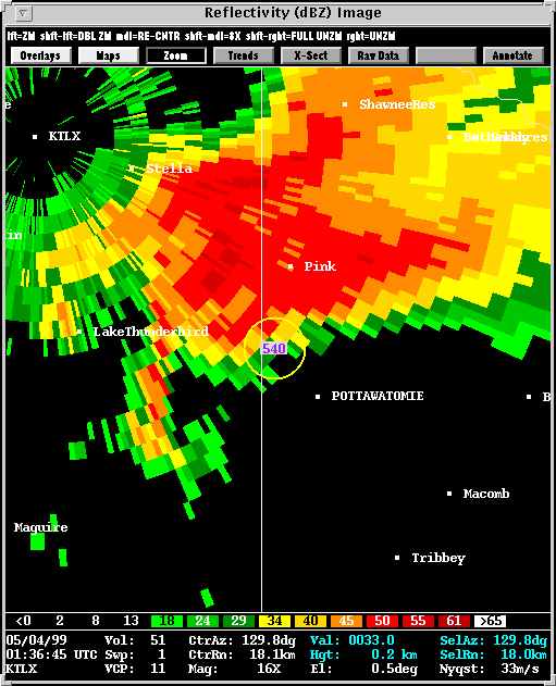
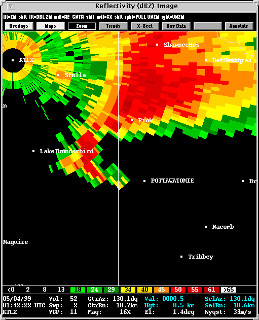
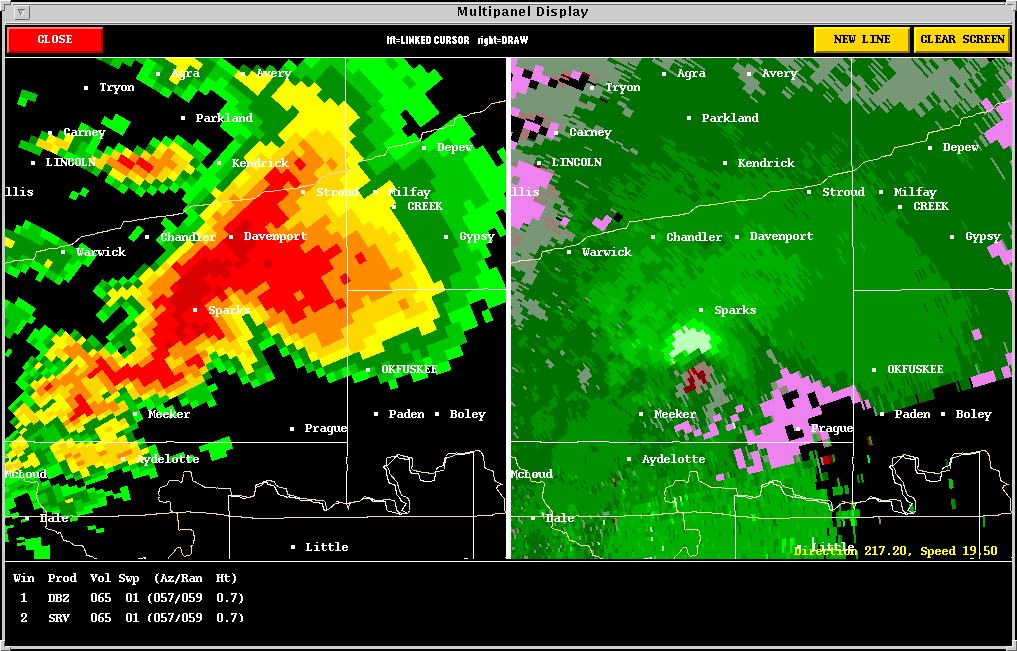
1. THE TORNADO NEAR PINK:
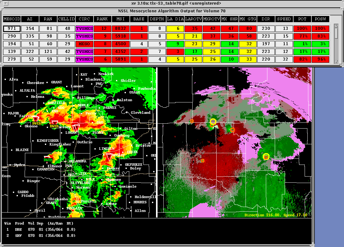
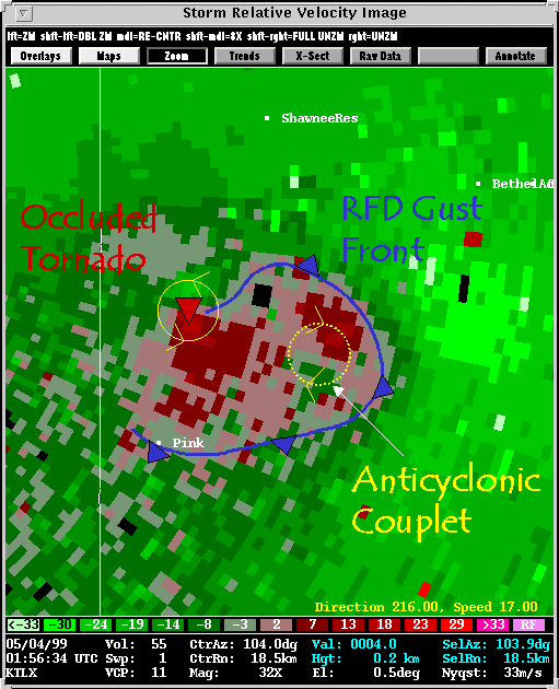
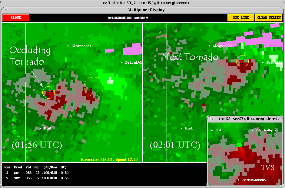
2. NEAR RANGE DETECTION ISSUES:
Description: One interesting
aspect of Storm D is its proximity to the radar. In near range storms,
the radar tends to observe a variety of vortices which would, in a distant
storm, would be smoothed out by the broader beam width. The existence
of several vortices of all depths and orientations within a single storm
presents a challenge to any algorithm attempting to identify and categorize
them. The three links above attempt to offer some insight into these
challenges.
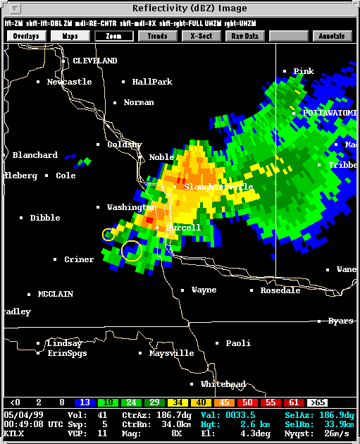
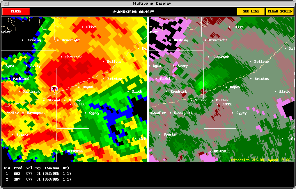
3. THE SHAWNEE to MEEKER TORNADOES:
Description: The tornado near
Pink lasted about 17 minutes. Then, around (01:56),
this tornado occluded. The storm cycled rapidly, putting down its
next tornado at (02:00) near
Shawnee. By (02:16),
the radar images were becoming very ominous as the tornado approached Meeker.
4. THE STROUD TORNADO:
Description: Following the
tornado near Meeker, Storm D quickly evolved into an HP supercell.
Other storms can be seen forming upstream of Storm D at (02:46).
These contributed to the storm's HP nature by seeding it with precipitation.
![]()
**Move
on and Examine Storms C,H,I,E
**Return
to Overview Page