
Southwest Colorado Project
A collaborative project for observing details of thunderstorm rainfall in southwest Colorado
Objective
The 2010 Southwest Coloraro Project seeks to research improvements in remotely sensed rainfall estimates in southwest Colorado. Southwest Colorado resides in a region not optimally observed by surrounding NWS radars. The NWS WSR-88D radars often see only the upper parts of thunderstorms leaving uncertainties as to surface rainfall rates. An emphasis is placed on flash flood monitoring in and around the San Juan Mountains and determining the utility of real-time radar information for improving precipitation monitoring. NSSL will deploy the C-band dual-polarization Shared Mobile Atmospheric Research and Teaching Radar (SMART-R) to collect data in southwest Colorado. Seventeen recording rain gauges were installed by the National Center for Atmospheric Research to help calibrate the radar data. The University of Colorado has deployed two optical disdrometers and a vertically-pointing micro-radar at Ft. Lewis College. These instruments will be used to validate radar rainfall estimates. Near-realtime SMART-R radar data will be transmitted to the NWS WFO Grand Junction, CO and Albuquerque, NM for comparisons with operational observations. This field project will be conducted during August 2010 with a focus on storms occurring over the San Juan Mountains. The NSSL Q2 projectOffsite link warning will be a test bed platform for the merging of SMART-R radar data with data from surrounding WSR-88D radars.
Project Goals
- Explore the use of a C-band research mobile Doppler radar with dual polarization for observing details of thunderstorms in southwest Colorado. Supplemental radar data are expected to aid in local hazard warnings and benefit emergency response efforts to protect lives and property.
- Demonstrate the potential of a gap filling radar in Southwest Colorado
- Document the spatial and temporal characteristics of heavy rainfall
- Provide near real-time data for NWS assessment and demonstrate the utility of a local radar for improved detection of flash floods
- Advanced evaluation of dual-polarization rainfall algorithms (post-analysis)
Deployment
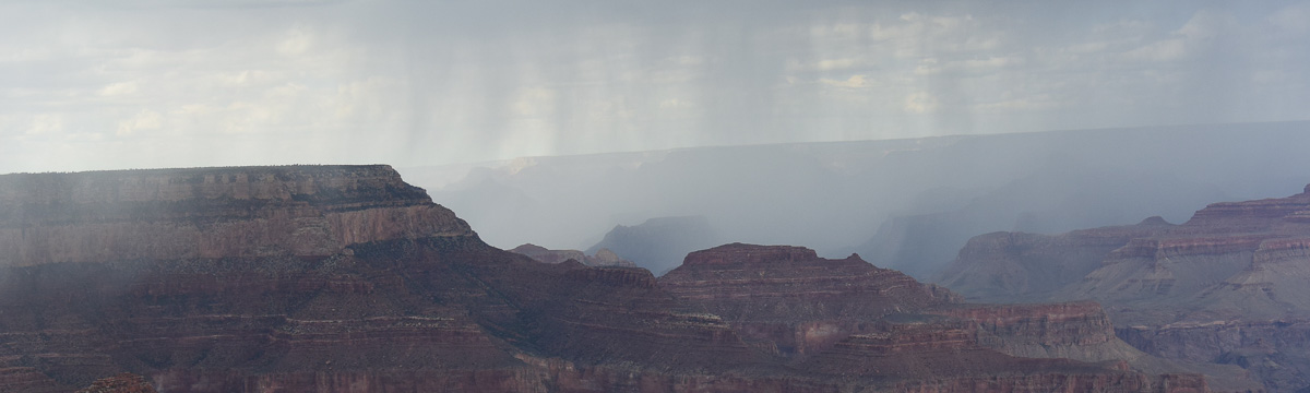
The SMART-R site location is located on Bridge Timber Mountain, southwest of Durango at ~8250 ft above sea level. The Southern Ute Indian Tribe has graciously granted access to this valuable location. Radar coverage is optimized to scan over upper basins of the primary streams and rivers of the San Juan Mountains. However, the site allows a panoramic view of the entire region out to 250 km range.
Data application methodology
SMART-R radar processing for use by the NWS.
Overview
The NSSL will provide supplementary rainfall rate fields to the Flash Flood Monitoring and Prediction system used by the NWS for operational flash flood warnings. Data will be provided electronically in near-realtime.
Description
SR2 data will be transmitted via a Motosat satellite uplink or cell phone modem to a server at the NSSL. The data will be processed and merged into NSSL's next-generation quantitative precipitation estimation system (Q2)Offsite link warning. The Q2 system will a) convert SR2 radar data from polar coordinates to a 1 km x 1 km grid. A separate quality control algorithm will be used to remove ground targets and other contaminates. Then the gridded SR2 data is merged with surrounding radar. A dynamic radar-rain rate relation (i.e., Z-R) algorithm will use environmental data to assign a special rainfall rate to each grid point. The final gridded field of mosaiced rain rates from regional radars will be sent to WFO GJT and ADQ offices via LDM, a standard communications protocol, for input into the Flash Flood Monitoring and Prediction - Advanced (FFMP-A) system. FFMP-A is an advanced version of FFMP that can ingest gridded data from multiple radars while FFMP ingests data from only a single radar. FFMP and FFMP-A uses sub-basin rainfall rate thresholds for warnings.
Collaborators
Principle Investigator:
- Steve Vasiloff, NOAA National Severe Storms Laboratory
Project Collaborators:
- Mike Meyers, NWS WFO, Grand Junction
- Jim Pringle, NWS WFO, Grand Junction
- Deirdre Kann, NWS WFO Albuquerque
- Dave Gochis, National Center for Atmospheric Research
- Katia Friedrich, University of Colorado
Project Sponsors:
- State of Colorado DOLA/Division of Emergency Management
- Colorado Water Conservation Board
- Southwestern Water Conservation District
- Southern Ute Indian Tribe
- Durango-La Plata County airport
- Fort Lewis College