
RiVorS: Rivers of Vorticity in Supercells
Collaborative effort looks for tornado clues only seen in simulations
Research meteorologists from several universities are joining scientists from the NOAA National Severe Storms Laboratory for a small, mobile field project to study thunderstorms and tornadoes from May 20 through June 8, 2017.
During RiVorS, the Rivers of Vorticity in Supercells project, researchers take their instruments to the storms, migrating throughout the central Great Plains from Texas to North Dakota.
The goal of the project is to capture measurements of near surface conditions (wind, temperature, dew point, pressure), and determine if shifts just above the ground occur in a specific area within supercell thunderstorms. These shifts may be associated with vorticity rivers, streams of air containing the rotation that can feed tornadoes. Vorticity rivers have been seen in thunderstorm simulations, but evidence of their existence has not been found in actual storms.
The long-term goal of this research is to help develop reliable probabilistic guidance products, enhance capabilities for WSR-88D and provide and communicate warning uncertainty information for high-impact weather events.
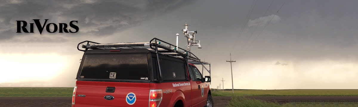
Researchers from NSSL drive two mobile mesonets, vehicles with instruments mounted on them, into the area just north of where a tornado might be expected to form. The goal being to try and measure these features that recent model simulations suggest should be present. To place these observations in the context of the larger storm however, additional instrumentation is needed. A mobile X-band radar called NOXP will be used to scan the thunderstorm from a distance, showing what the structure of the storm looks like if and when these rivers are found at the surface. To assess what type of environment is feeding the thunderstorm, the Collaborative Lower Atmospheric Mobile Profiling System, known as CLAMPS-2, will use instruments mounted in a trailer to profile the lower portion of the atmosphere for temperature, humidity, and winds.
Collaborative partners include the University of Colorado and University of Nebraska-Lincoln flying unmanned aerial systems, Texas Tech University (TTU) operating their ka-band Mobile Doppler Radar (TTUka), and Penn State University launching balloons carrying a Quasi-Lagrangian Drifter probe.