Tracking Convective Clouds
(NYC): 06 June 2005
Robert Rabin1
1NOAA/NSSL and
UW-Madison/CIMSS
BACKGROUND
This web page shows some results from the NSSL/CIMSS tracker program.
The images shown here were obtained from the on-line tracking tool (near real-time
and archive). This tool provides 3-hr loops of GOES IR and radar
overlays (15-minute intervals), tracks of centroid positions for a
range of cloud top temperature thresholds, and time-series of cloud
size, mean cloud top temperature, and environmental conditions form the
RUC analysis. More information on the tracking tool is available here.
Java based applications used for interactive animations were
developed
by Tom Whittaker of the Space Science and Engineering Center SSEC,
University of Wisconsin-Madison.
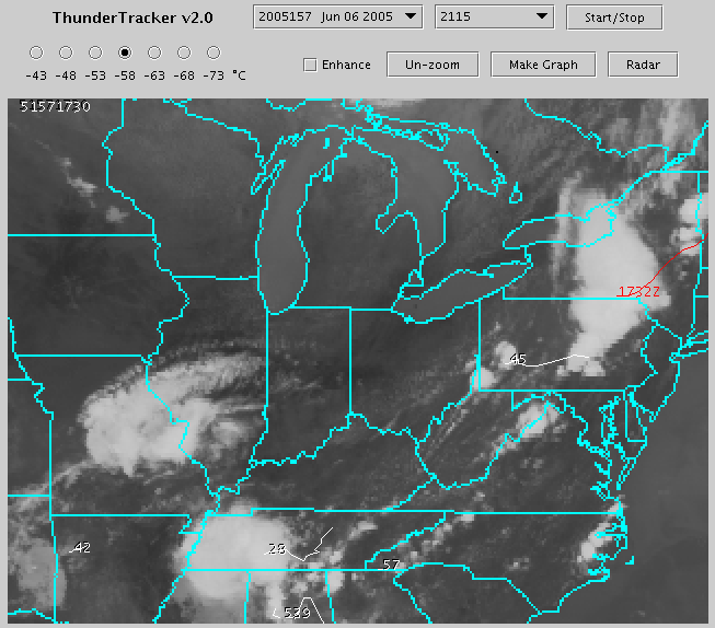
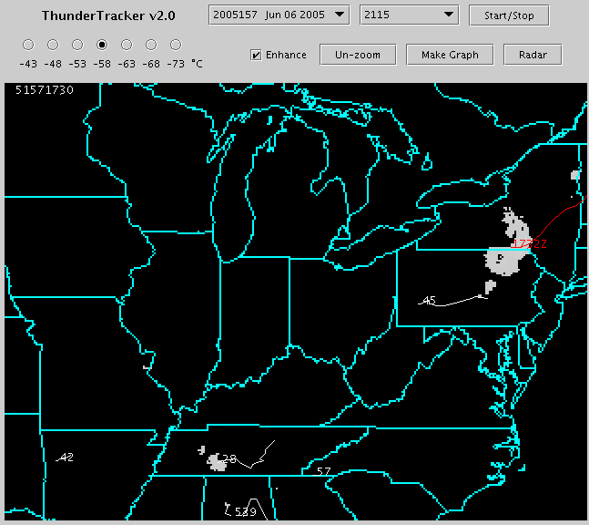
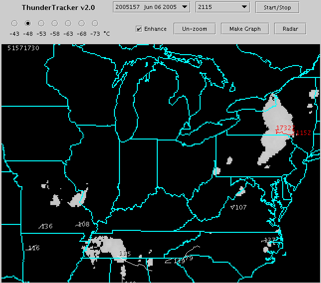
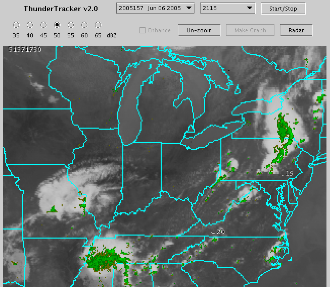
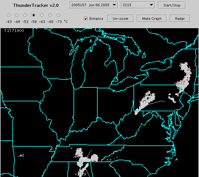
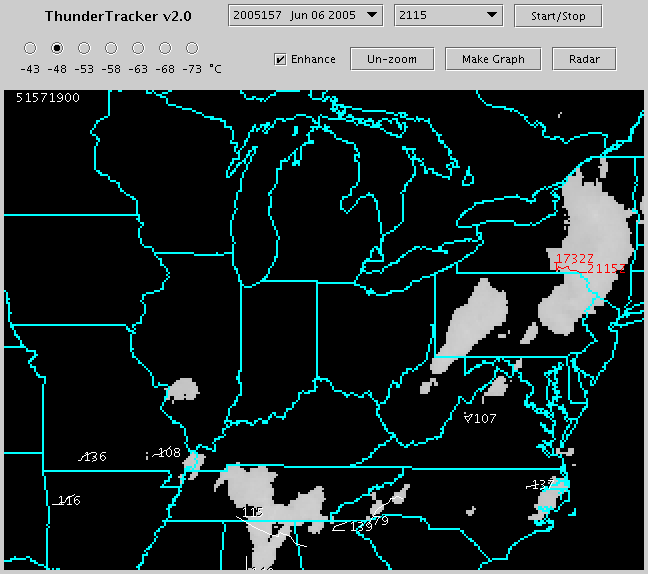
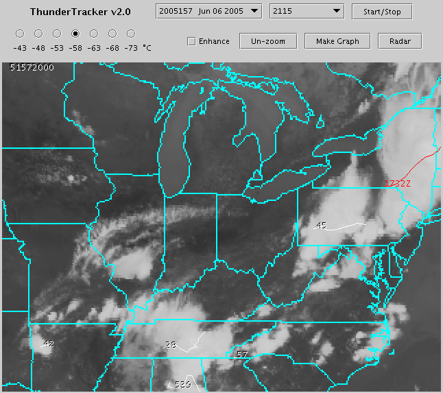
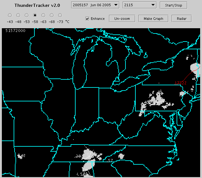
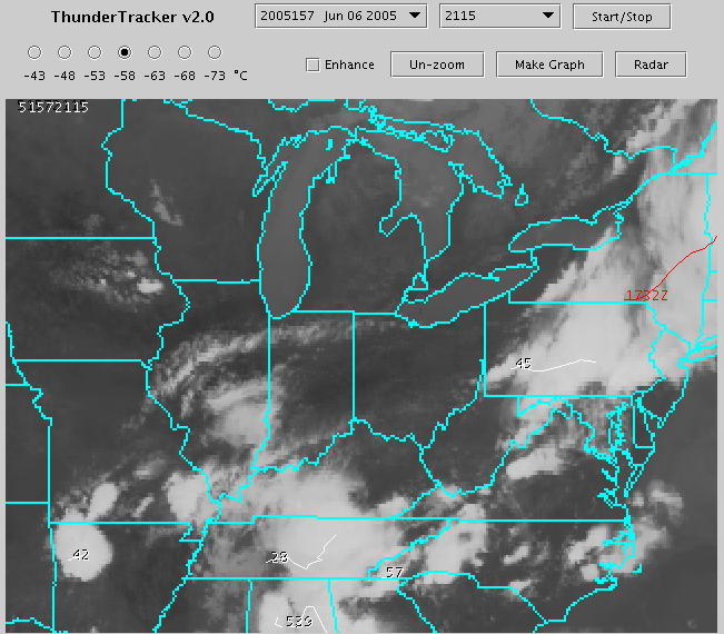
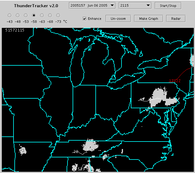
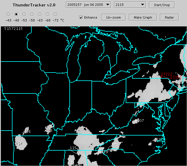
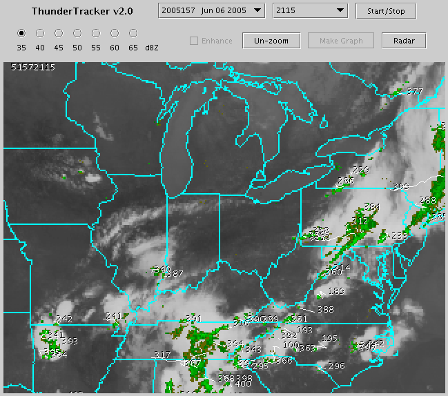
Table 1. Satellite and
radar images with track of centroid position overlay (-48 and -58 C
thresholds).
Time
|
IR image
|
IR image
(clouds < -58 C shown)
|
IR image
(clouds < -48 C shown) |
IR + radar
reflectivity
|
06 June 05
1730 UTC
|
X
|
X
|
X
|
X
|
06 June 05
1900 UTC
|
X
|
X
|
X
|
X
|
| 06 June 05
2000 UTC |
X
|
X
|
X
|
X
|
| 06 June 05
2115 UTC |
X
|
X
|
X
|
X
|
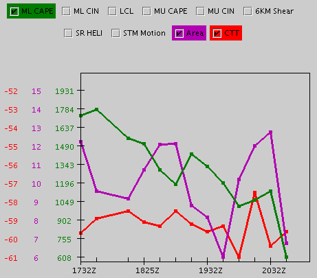
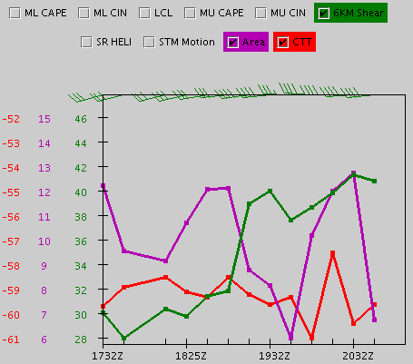
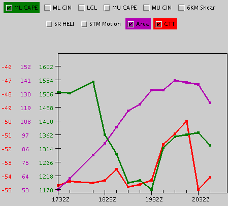
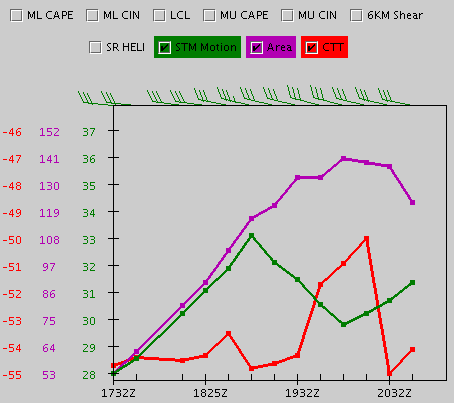
Table 2. Example time
series plots (for red tracks in Table 1 figures).
Track from
-58 C Threshold
|
Size, Tave, CAPE
|
Size, Tave, Wind shear (6 km)
|
Size, Tave, Motion (Bunkers
modeled)
|
Track from
-48 C Threshold
|
Size, Tave, CAPE |
Size, Tave, Wind shear (6 km) |
Size, Tave, Motion (Bunkers
modeled) |
____________________________________________________________________________________________________
Table 3. GOES Hydroestimator
(HE) and HydroNowcaster (HN) output
Table 4. Comparison of
1-hour accumulation
HN
versus Stage-IV QPE (Click on box marked "Stage-IV QPE" to toggle
between HN and Stage-IV")
Disclaimer. The products from GOES or other
satellites
shown here are experimental. These have been generated within a
research environment and are not intended to be considered operational.
Timeliness, availability, and accuracy are sought but not guaranteed.
Return to CIMSS
(UW-Madison)
or NSSL (NOAA/NSSL).
Last update was 16 May 2007. Feedback.