Robert Rabin1
1NOAA/NSSL and
UW-Madison/CIMSS
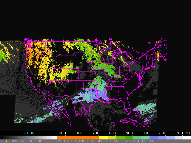
Estimates of Cloud Top Pressure (CTP), Cloud Top Temperature (CTT),
and Effective Cloud Amount (ECA) from the GOES sounder are used to
infer temperature near the level of nondivergence in clouds where
saturated ascent exists through a deep layer. The purpose is to
estimate locations of high precipitation efficiency where dendritic ice
crystal growth is taking place. Studies have identified a relatively
narrow temperature range (centered near -15 C) at which dendritic ice
crystal growth by deposition and efficient snow production occurs
(e.g., Auer and White, 1982). An operational technique has been
proposed which evaluates areas where strong forcing for ascent
coincides with regions of sufficient moisture and temperatures
favorable for maximum depositional growth (Wetzel and Martin,
2002). The analysis technique outlined here, together with
analyses from numerical models may be of use in assessment of such
regions.
The technique used here is as follows:
Sounder products are obtained hourly from the Cooperative Instutute
of Meteorological Satellite Studies (CIMSS),
University of Wisconsin-Madison. They are McIDAS image areas from
the GOES-12 and GOES-10 sounders representing cloud information.
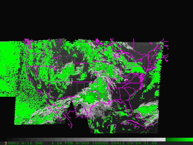
The ECA is used to screen out thin or broken cloud layers. Currently, a
minimum threshold of 98% is used to process cloud information.
Next the CTP and CTT are used to compute the equivalent potential
temperature (EPT) at cloudy points (assuming saturation). For
points where CTP is less than 600 mb, the temperature at the level of
nondivergence is computed from the EPT (again assuming
saturation). Currently, the level of nondivergence is assumed to
be near 600 mb, typical for significant snow events (Auer and White,
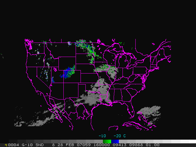
1982). An image is made which highlights the in-cloud temperature
near -15 C at 600 mb (see T(600 mb) in Table 1).
In addition, another image is created which shows the pressure at
which in-cloud temperatures are near -15 C (see P(-15 C) in Table
1). This is computed from cloud top pressure and temperature (for
clouds with top temperature less than -15 C). From this image,
variable levels can be identified where dendritic growth may be
important (not just 600 mb). A refinement to be added in the
future is to utilize
a mesoscale forecast model (such as the RUC) to determine the upward
motion at each of these pressure levels.
With the help of a model analysis, it might also be possible to
identify isolated cloud layers which are above a continous layer of
moist ascent. Such layers can give a erroneous result (too warm)
and can obscure the relevant cloud tops below. It is important to
identify such situations.
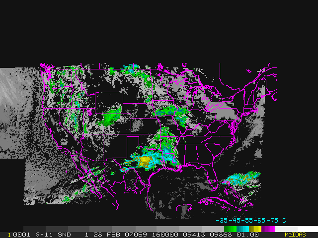
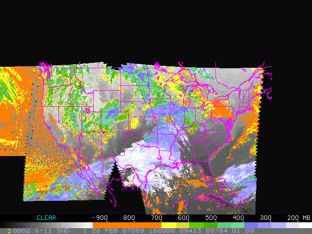
| CTT (IR
window: 11 microns, deg C) |
CTP (mb) |
ECA
(per cent) |
T(600mb)
deg C |
P(-15C) mb |
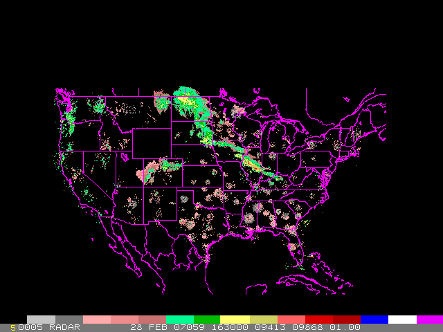
Radar
Reflectivity |
| Time Period
(UTC) |
P(-15C)
w/overlays |
T(600)
w/overlays |
CTT |
CTP |
ECA |
T(600) |
P(-15C) |
Radar |
| 0000-0500 |
X |
X |
X |
X |
X |
X |
X |
X |
| 0600-1100 |
X |
X |
X |
X |
X |
X |
X |
X |
| 1200-1700 |
X |
X |
X |
X |
X |
X |
X |
X |
| 1800-2300 |
X |
X |
X |
X |
X |
X |
X |
X |
Auer, A.H., J.M. White, 1982: The combined role of kinematics,
thermodynamics and cloud physics associated with heavy snow episodes.
J. Meteor. Soc. Japan, 60, 500-507.
Wetzel, S.W., J.E. Martin, 2001: An operational ingredients-based
methodology for forecasting midlatitude winter season precipiation.
Wea. Forecasting, 16, 156-167.
Return to CIMSS
(UW-Madison)
or NSSL (NOAA/NSSL).
Last update was 24 January 2005. Feedback.