Challenging Detections
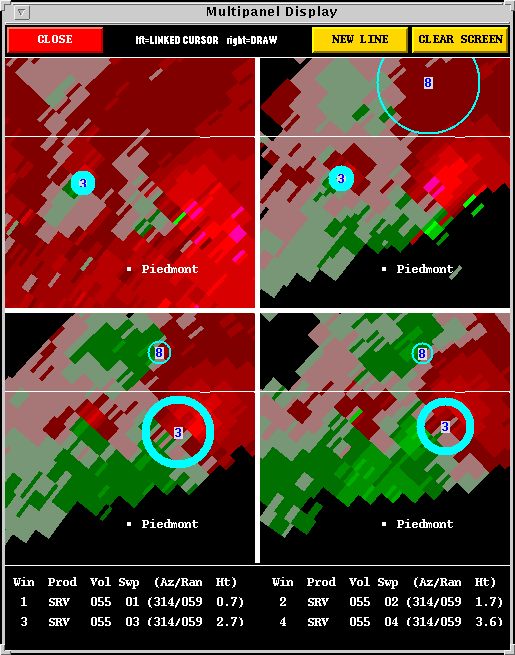
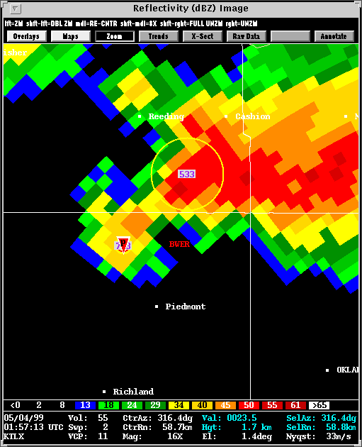
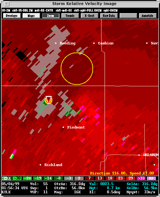
Vertically associating 2-D shear features to create a 3-D mesocyclone presents many difficulties. In this case, there are three pronounced regions of shear within a single thunderstorm. The relatively small, occluding vortex is detected on titls 1 and 2. At tilt 3 there are not enough gates of inbound velocities to meet the 2-D shear requirements of the MDA.
However, a new detection is made a few km to the east. The algorithm finds this to be the vertical continuation of the occluded vortex, which, to the human radar operator, it clearly is not. The circulation to the east is, in fact, a new mesocyclone at the storm's triple point, and a newly growing tornado threat. The resolution capabilities of the
algorithm prevent the new meso from being detected until the next radar volume.
Looking at the bigger picture, a trained severe weather forecaster would, no
doubt, recognize these two mesocyclones as separate entities. Therefore, this particular missed detection is of little consequence, but is intended to illustrate some of the issues involved in developing a robust radar algorithm.