Mesocyclone Time/Height Trend (Shear in 10^-3 s^-1)
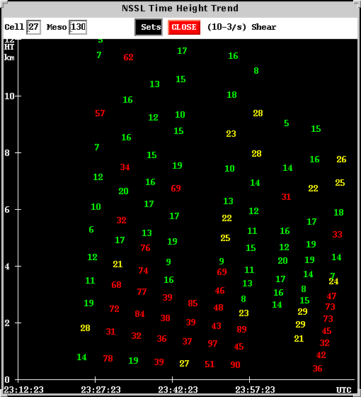 The first column of numbers on the left represents shear through the depth of the algorithm defined mesocyclone when the Oklahoma City tornado first touched down near Chickasha. The mesocyclone rapidly
intensifies by the next volume, and maintains strength for some time. At the time of the final column, (00:12), the tornado was about to enter the city of Moore. The low levels of the mesocyclone remained intense. Data at higher levels
appears more sporadic.
The first column of numbers on the left represents shear through the depth of the algorithm defined mesocyclone when the Oklahoma City tornado first touched down near Chickasha. The mesocyclone rapidly
intensifies by the next volume, and maintains strength for some time. At the time of the final column, (00:12), the tornado was about to enter the city of Moore. The low levels of the mesocyclone remained intense. Data at higher levels
appears more sporadic.