
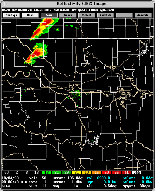
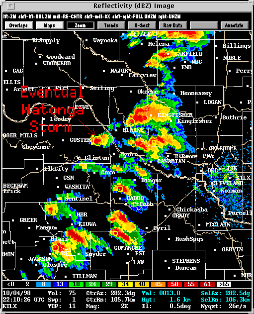
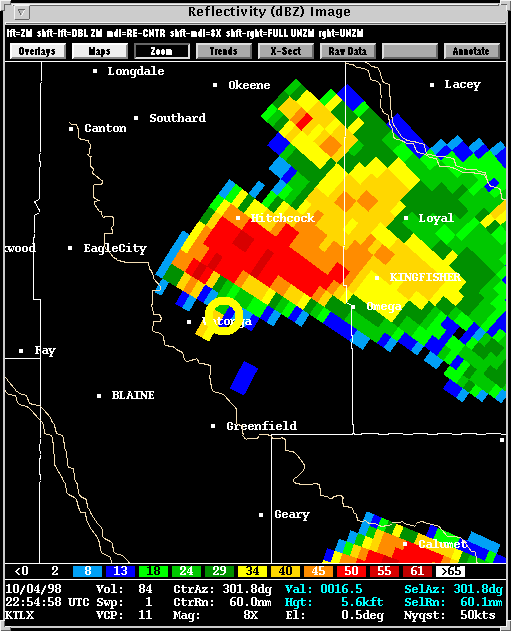
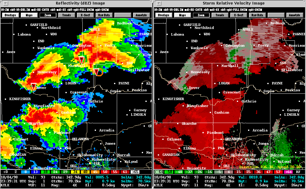
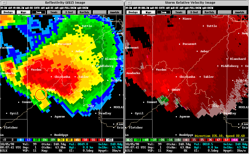
The October 4th, 1998, tornado outbreak in Oklahoma was uniquely impressive. Not only was it a record setter for the month, but this tornado outbreak even ranks highly among the more typical springtime events. A variety of storm morphologies and resulting tornadoes were observed. From HP to LP; wedge to tubular; day to night, this event seemed to cover all bases, and will serve researchers as a valuable case study.
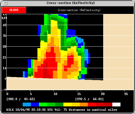
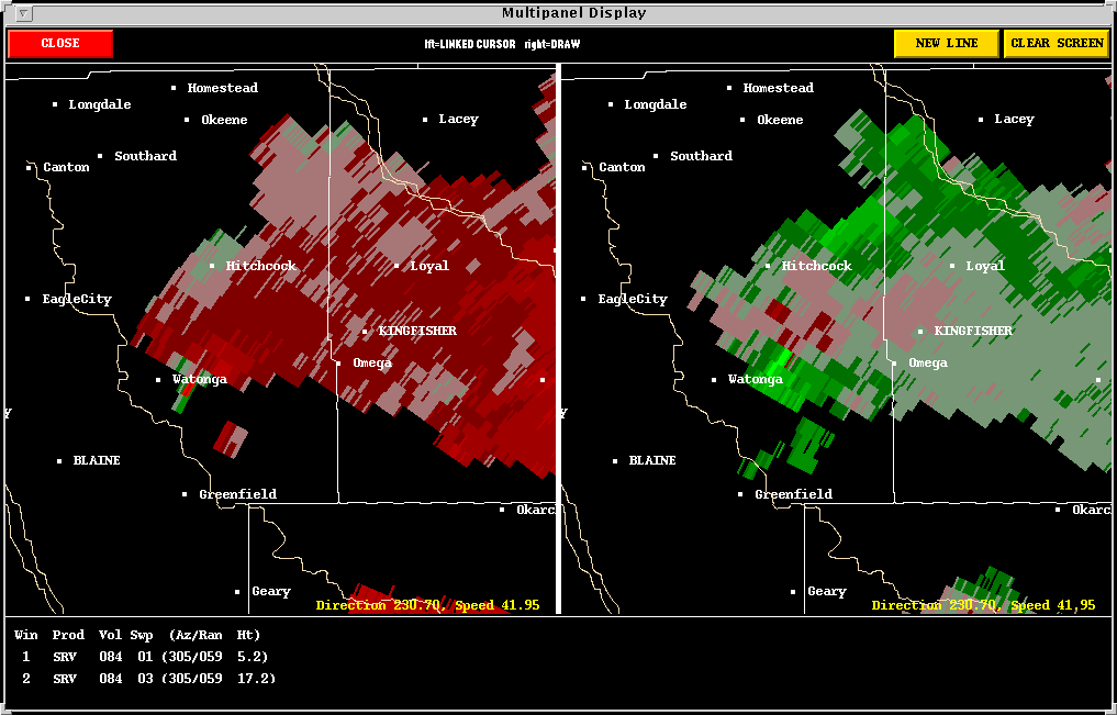
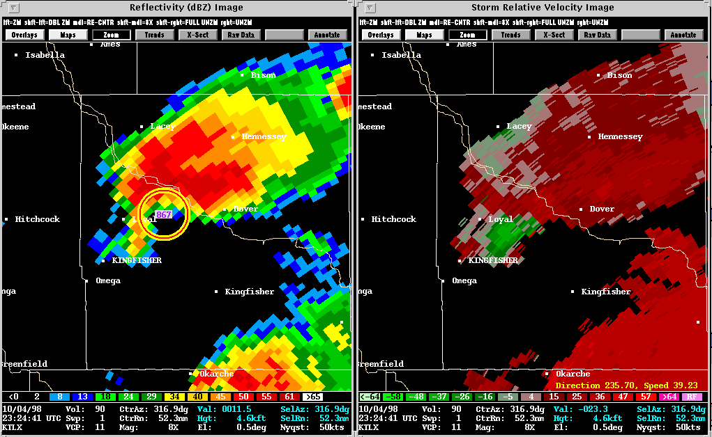
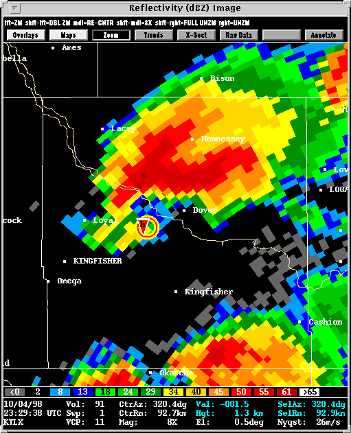
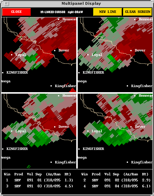
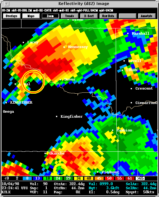
Presented here are various WSR-88D radar images from the Norman, OK
(KOUN) radar. Included in some of the images is output from NSSL's Mesocyclone
Detection Algorithm (MDA) and Tornado
Detection Algorithm (TDA). A yellow circle represents a mesocyclone
as detected by the MDA. The red-in-yellow circle represents a mesocyclone
whose base is at the lowest radar scan (where it is a more likely tornado
threat). A red triangle indicates the location of a tornado as detected
by the TDA.
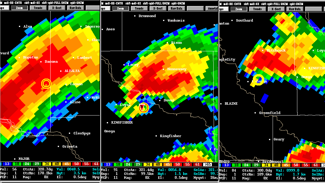
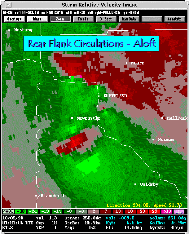
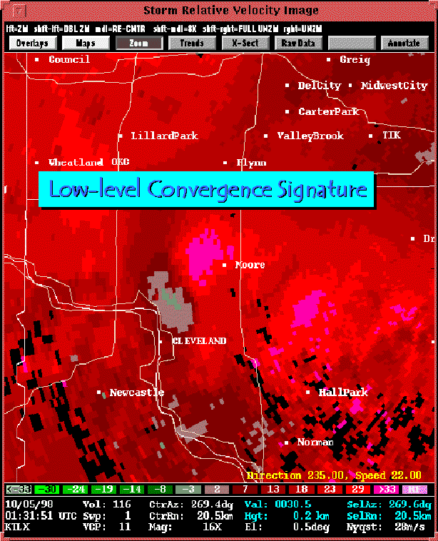
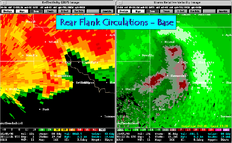
The Moore tornado resulted in F2 damage in the city of Moore. Interestingly, along the same rear flank which produced the Moore tornado, there existed several noteworthy circulations. At least one is known to have produced a brief F0 tornado.
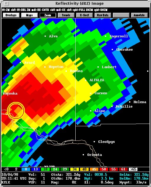
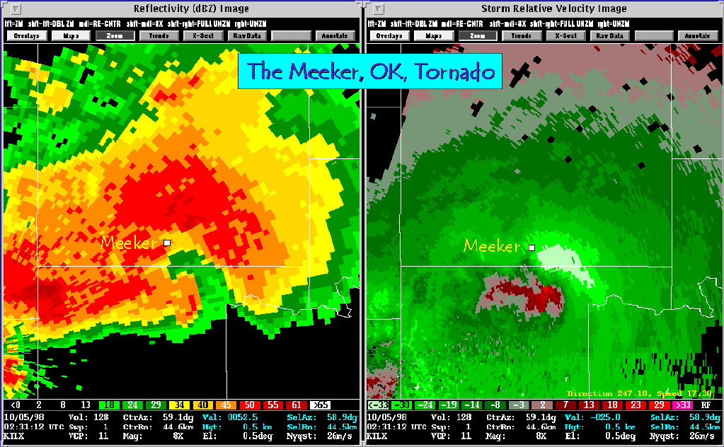
The same scenario, multiple circulations along a single flank, developed later that evening just east of the KTLX radar site. This particular storm took on an incredible appearance with a very large, rain-wrapped hook. Three tornadoes touched down east of Meeker, OK.
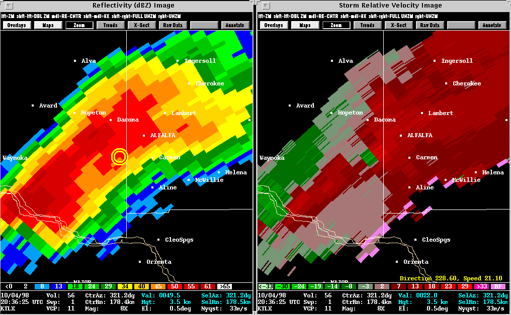
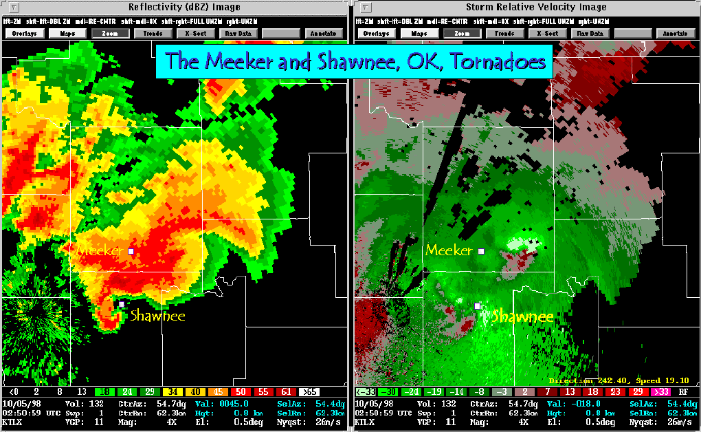
Yet another tornadic storm developed in the Shawnee, OK, area. The 0250 UTC images show that the forward flank of the Shawnee storm overlapped the rear flank of the Meeker storm. As a result, the Meeker hook echo is obscured in the reflectivity product, but the circulation stands out extremely well in the storm relative velocity product.
The National Weather Service has conducted damage
surveys of both the Meeker and Shawnee storms.
Back
to NSSL SWAT Case Study Table of Contents Page.