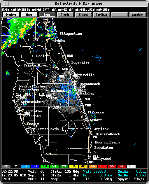
Presented here are various WSR-88D radar images from the Melbourne,
FL radar (KMLB).
The radar is always to the south and east of the images presented here
with the exception of the earlier storms at the bottom of this page.
Range Folded echos have been removed from all images to improve clarity.
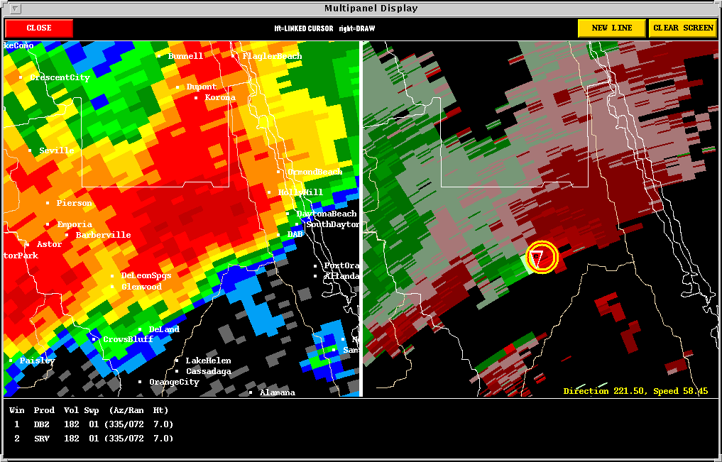
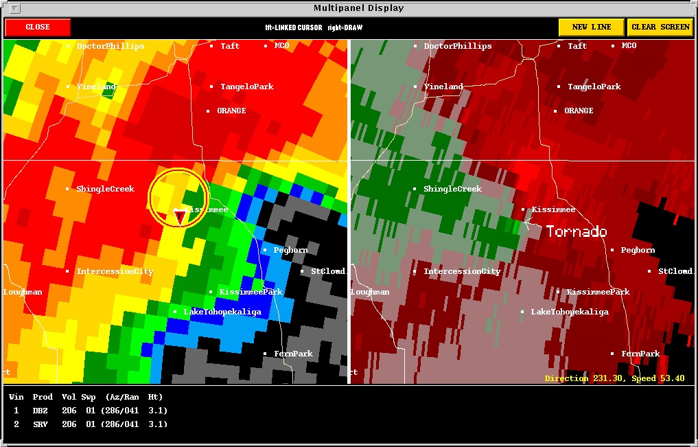
Included in some of the WSR-88D images is output from NSSL's Mesocyclone Detection Algorithm (MDA) and Tornado Detection Algorithm(TDA). A yellow circle depicts a mesocyclone. The red-in-yellow circle depicts a mesocyclone whose base is at the lowest radar scan (where it is a more likely tornado threat). A red inverted triangle depicts a Tornadic Vortex Signature (TVS) detection.
These images are from NSSL Radar and Algorithm Display System (RADS)
that is part of NSSL Warning Decision Support System (WDSS). The
WDSS is a real-time operational warning guidance system that contains images
and overlays of NSSL enhanced WSR-88D algorithms and novel display concepts.
The WDSS was running in real-time during this event at the
National Weather Service Office in Melbourne, Florida, and offered
a unique perspective on the event that very few NWS offices in the U.S.
have yet to enjoy. These links contain more information about this
event:
![]()
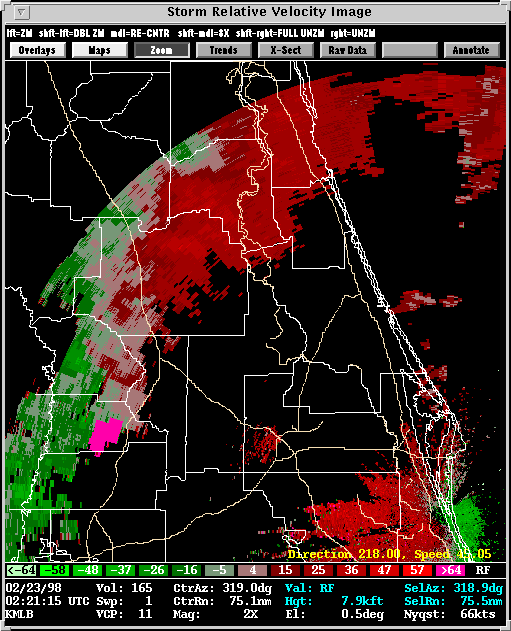
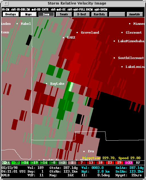
The Two Panel TVS image demonstrates
the presence of an intense mesocyclone in the absence of a reflectivity
"hook.." The NSSL MDA and TDA use velocity data, not reflectivity
data, when searching for mesocyclones and tornadoes. This particular
velocity frame has a dealiasing error, meaning the radar could not properly
measure the radial component of the wind. The affected area is the
bright green stripe underneath the mesocyclone. Dealiasing errors
show up frequently enough to present a significant threat to algorithm
performance. However, this error occured in a place where it did
not hinder the algorithms.
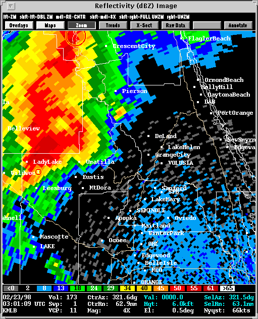
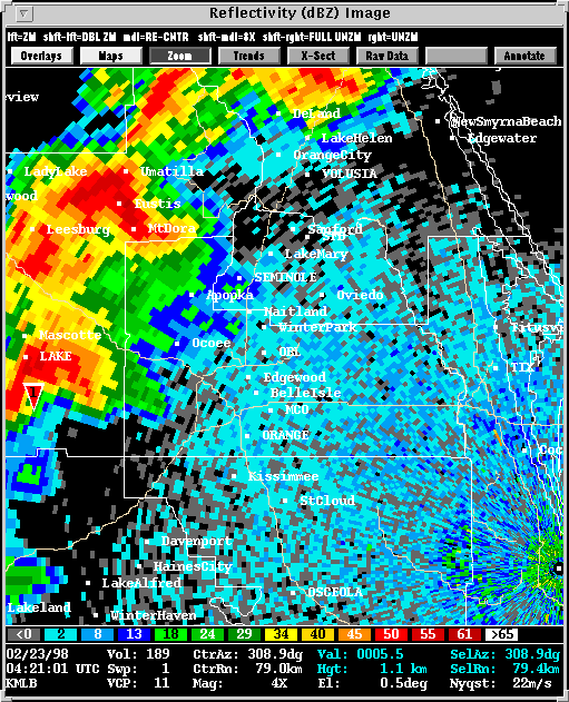
The reflectivity loop follows the lifetime of the Winter Garden storm; Winter Garden is near Ocoee which is just left of the center of the frame. The TVS associated with this storm moves from the middle-lefthand side of the image to the upper-righthand corner. Midway through the loop, the Kissimmee tornado touches down and shows up as a second TVS further south and west.
The Tornado Touchdown image shows that the MDA and TDA did their jobs with pinpoint accuracy in identifying the mesocyclone and tornado. It is said to be a (likely) tornado because efforts are still underway by the Melbourne, FL, NWS to verify the precise track of each tornado.
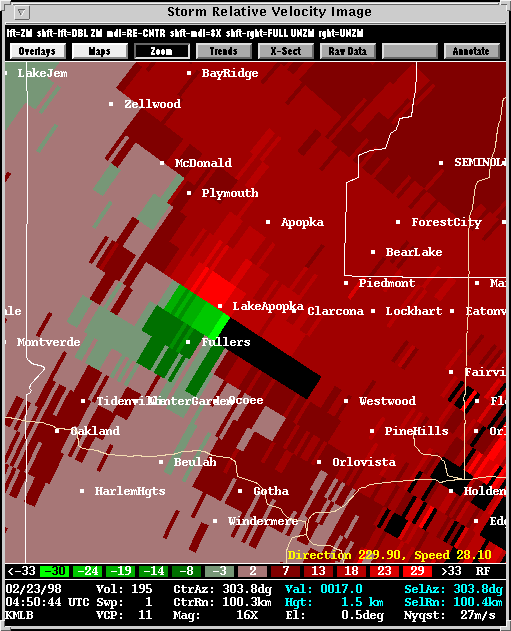
The Tornado Northeast of Winter Garden
was again detected despite a dealiasing error. The dealiased data
has been removed from the image, hence the blank stripe immediately southeast
of the mesocyclone.
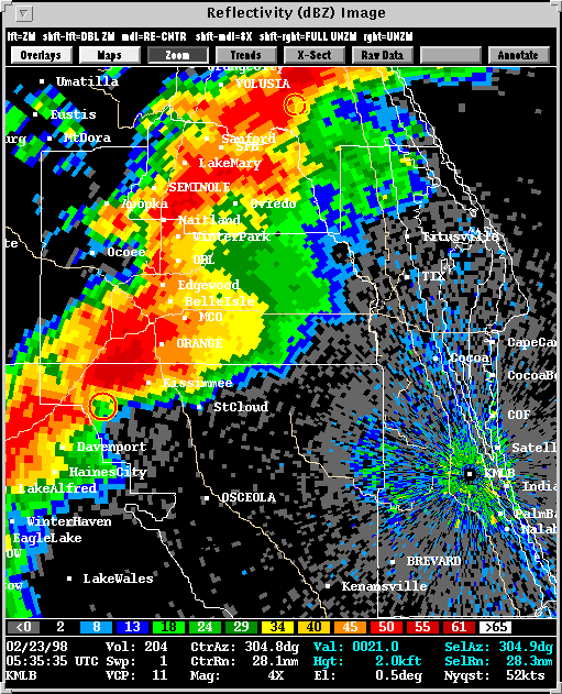
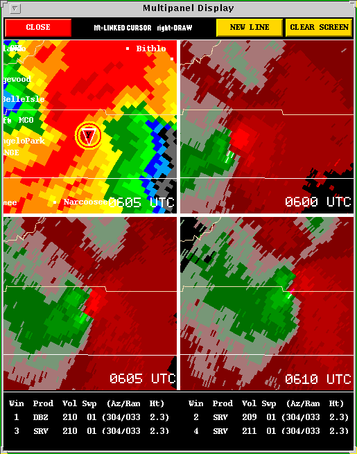
The Tradgedy at Kissimmee panel
shows radar products at the time at which the tornado was only one half
mile noth of downtown . The 4-Panel
Mesocyclone Images show that the mesocyclone became even more
ominous as viewed by the WSR-88D when it had moved east of Kissimmee.
![]()
1) The violent, overnight storms formed on and moved along a clearly
defined surface
Outflow Boundary.
2) The violent, overnight storms took place in an environment which had more directional as well as speed shear due to the presence of a very strong jet max.
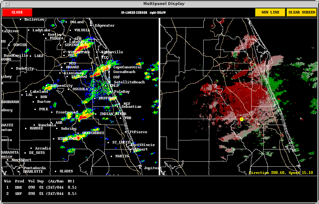
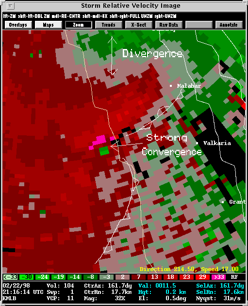
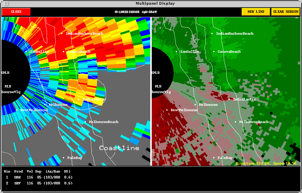
The Near Range Storm exhibits a pronounced reflectivity "hook," on it's south side, and a divergence signature northeast of the "hook," both of which are consistent with supercell structure. A Closer Look depicts these supercell characteristics, along with associated boundaries. Despite the impressive structure, this storm did not produce a tornado.
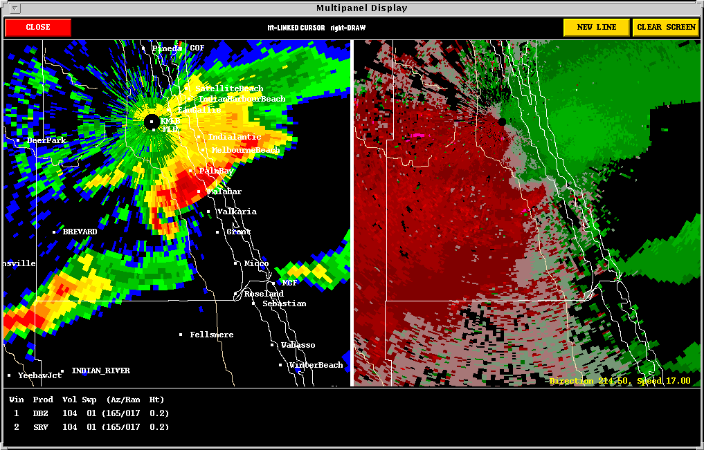
A similar storm nearby did, however, produce a tornado/waterspout near Indiatlantic. The "hook" is again impressive, and is outlined in the image. The velocity portion of the image confirms the existence of a broad, well established mesocyclone which is not present in the other Near Range Storm.

Back
to NSSL SWAT Case Study Table of Contents Page.