![]()
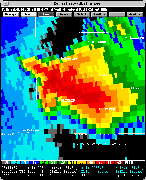
Several supercells occurred in the Texas Panhandle on this day. Wheeler county was hardest hit when a mile wide F3 tornado tracked from just southeast of Kellerville across Interstate 40 to just southwest of Lela. Softball size hail was observed in Shamrock from the core of this tornadic storm. Other storms produced brief tornadoes and severe hail throughout the evening.
June 11 1997, presented an interesting lesson in tornado formation.
The Kellerville F3 tornado formed
in classic, predictable fashion, beginning with broad mid-level rotation
which built its way down to the storm base. A strong rear flank downdraft
ultimately brought the circulation to the ground, a mile wide and shrouded
in precipitation.
Meanwhile, only some 20 miles to the south of Kellerville and not long
after the dissipation of that tornado, the author of this page witnessed
a smaller, more tube-like tornado nearest to Dozier. The
Dozier tornado developed from a much higher storm base, and well away
from the precipitation. The parent circulation did not extend to
the mid levels of the storm, and it originated at the storm base before
working its way up (opposite the Kellerville tornado). These two
tornadoes, having taken place in close proximity at nearly the same time
illustrate how distinctly different mechanisms are at work in the development
of tornadoes. Researchers have their hands full attempting to identify
those mechanisms.
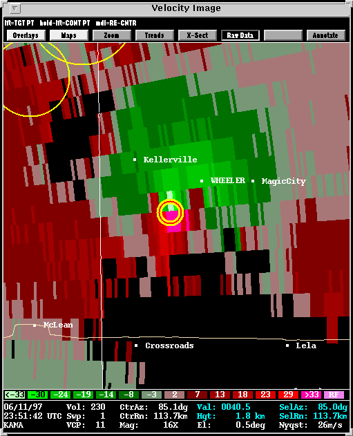
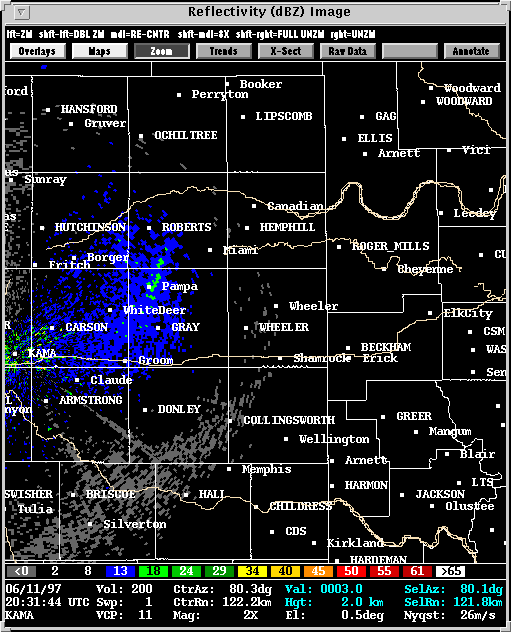
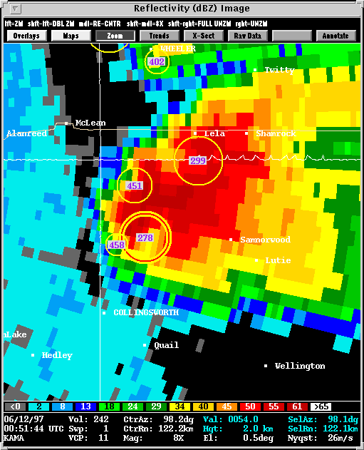
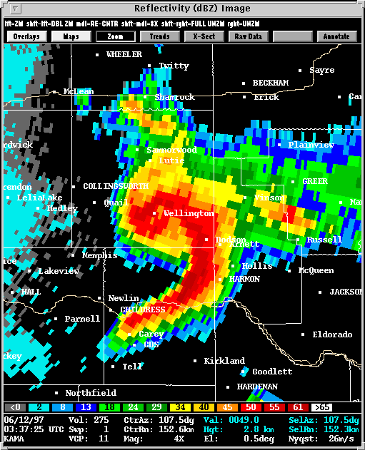
Presented here are various WSR-88D radar images from the Amarillo, TX radar (KAMA). Included in some of the images is output from NSSL's Mesocyclone Detection Algorithm (MDA). A yellow circle depicts a mesocyclone. A red-in-yellow circle indicates the mesocyclone extends to the lowest elevation scan of the radar (extists near or ar the base of the storm) where it is a more likely tornado threat.
Also of note is mesocyclone #299. This is what remained of the Kellerville tornado which lifted at 0032 UTC. The development of the Dozier storm disrupted the southwesterly inflow into the Kellerville tornado. Had this not taken place, the Kellerville tornado may very well have maintained itself. As it stood, the Kellerville tornado tracked 9 miles over 46 minutes.
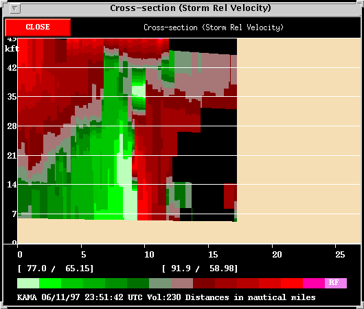
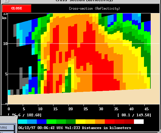
The Storm Relative Velocity Cross Section
is interesting to compare with that of the Kellerville
tornado (See previous discussion). It is quite clear from these images
that the Kellerville storm exhibited deep rotation whereas the Dozier tornado
was quite shallow.
The entire parent storm of the Kellerville tornado was rotating (green-inbound
velocities meet red-outbound velocities) up to about 28 thousand
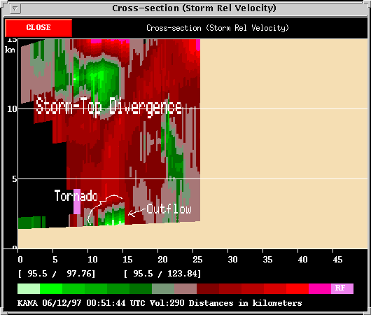
feet. Rotation with the Dozier storm really can only be seen at storm
base. The bright green-inbound velocities at the bottom center of
the inage represent strong storm outflow. This outflow slopes downward
until it is interupted by a thin column of red-outbound velocities.
This red column was the tornado. Indeed, the tornado was visually
observed to be forced westward by outflow at the ground. Aloft, the
tornado reached back toward the east, over the outflow.
Learn more about this event on Greg
Stumpf's Page.
Learn more about this event on Kevin
Scharfenberg's Page
Back to
NSSL SWAT Case Study Table of Contents Page.