
NSSL SWAT Case Study - 30 April 1994 Pennsylvania
Northeast U.S. Low Topped Supercell
The afternoon of April 30, 1994, provided one of many scientifically
important tornado events to have been witnessed by the WSR-88D radars since
their nationwide deployment. The particular supercell of interest
impacted the town of Pond Bank, PA. This was the first Northeast
U.S. low topped supercell ever recognized in WSR-88D data and archived
for analysis. Such events are critical to advancing our understanding
of various tornadic storms. As meteorologists, we do not have the
luxury of creating a particular weather event in a laboratory. The
atmosphere serves as our laboratory, and we must continuously monitor the
atmosphere to make use of the times when events create themselves.
Low topped supercells are rare, so the Pond Bank storm is one of many prized
possessions in the NSSL radar database.
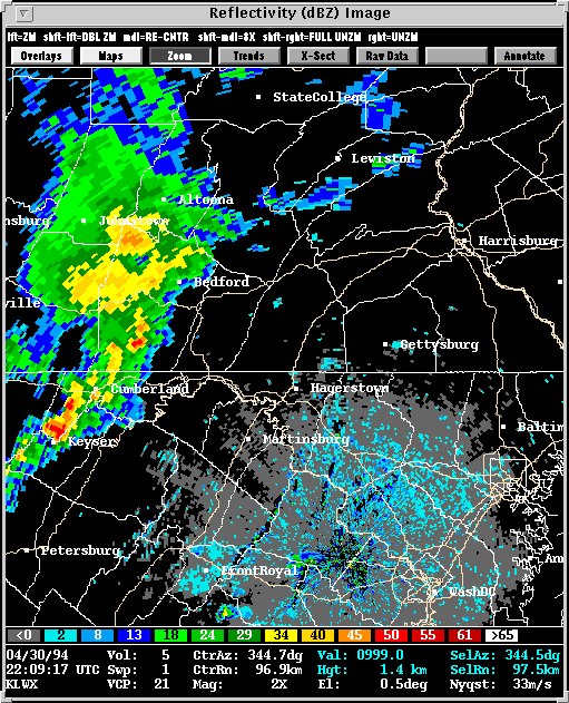
Presented here are various WSR-88D radar images from the Sterling, VA
(KLWX) radar. Included in some of the images is output from NSSL's Mesocyclone
Detection Algorithm (MDA) and Tornado
Detection Algorithm (TDA). A yellow circle represents a mesocyclone
as detected by the MDA. The red-in-yellow circle represents a mesocyclone
whose base is at the lowest radar scan (where it is a more likely tornado
threat). A red triangle indicates the location of a tornado as detected
by the TDA.
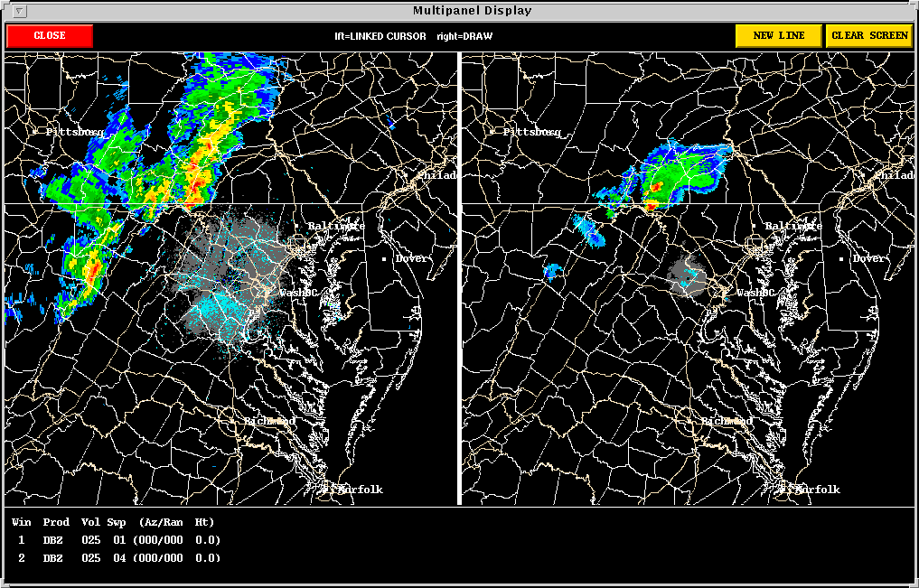
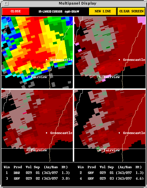
Description: In this case, the tornadic storms of interest
are not obvious on Sweep 1 (or base) reflectivity. A higher angle
radar beam, Sweep 5, however, overshoots the echos of lesser concern, and
reveals two supercells with taller, denser cores and extensive anvils.
See Sweep1 vs. Sweep5. The Storm
Evolution Loop, then, focuses on these two cells as the southern one
becomes tornadic and approaches Pond Bank (north of Hagerstown, MD).
-
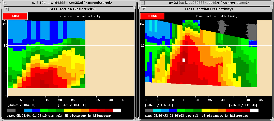
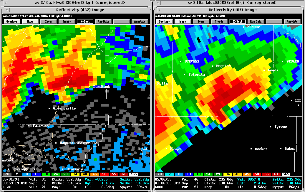
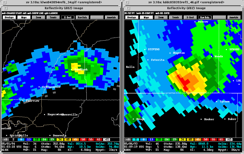
SUPERCELL COMPARISON: Low Topped vs. Classic
Note: In the following images, the Pond Bank storm (Left) is
compared to a Great Plains classic supercell (Right) from the Dodge City
WSR-88D (5/3/93).
Description: Compared to the Great Plains supercell,
the Pond Bank storm is very sheered over. It also has a much lower
top (by 5 km) and a somewhat less extensive core. See the Cross
Section.
The two storms do not look radically different at Base
Reflectivity, but the Pond Bank storm does have slightly smaller features.
The real differences show up around 11 km which is Sweep 6 for Pond Bank
but Sweep 5 for the Great Plains storm due to their respective distances
from the radars. The Upper
Region images reveal in the Great Plains storm high reflectivities,
a large core, and far-reaching anvil material. At this same height
in the Pond Bank storm, the radar beam lands slightly above the anvil,
near the top of the overshoot, and reflectivities are less expansive or
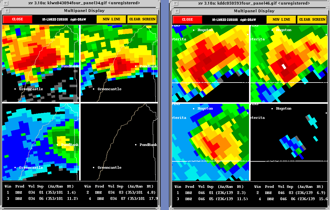
intense. The Four Panel
image further examines the difference in reflectivities at various heights.
-
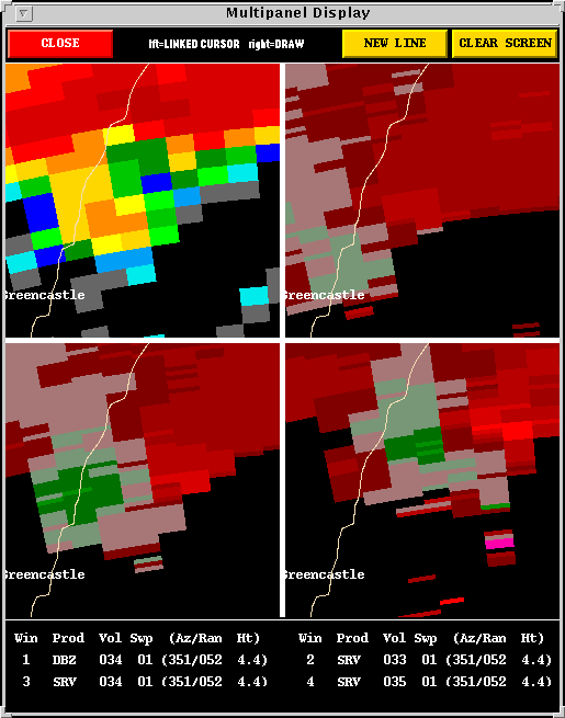
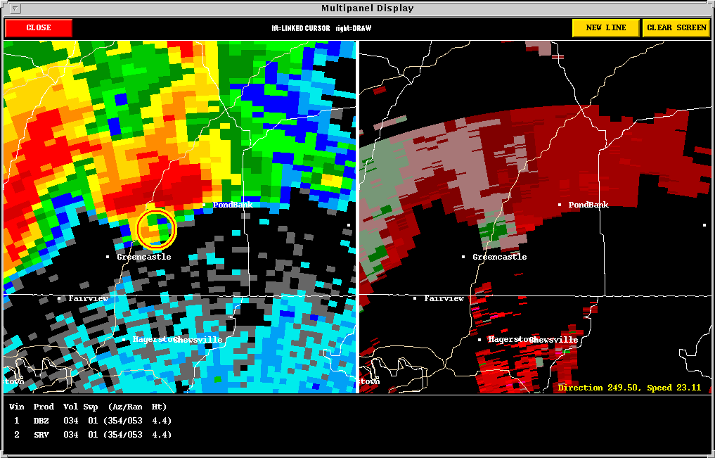
THE POND BANK TORNADO (F2):
Description: A significant mesocyclone developed and
produced an F1 tornado in the township of Antrim, PA, at 0030
UTC. The storm continued to strengthen as it approached Pond
Bank, and at 0059 UTC a second tornado
formed. This tornado tracked roughly six miles, doing significant
damage to property before dissipating in Pond Bank. Unfortunately,
there were also two serious injuries. Valuable data was
obtained from this Northeast U.S. Low Topped Supercell.
Back
to NSSL SWAT Case Study Table of Contents Page.