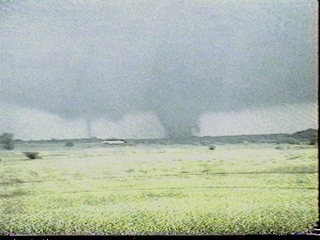
Touching down in rural Southwest Oklahoma, the Stecker tornado was the first significant tornado of the outbreak, as well as the first from the long track supercell that struck Oklahoma City some two hours later.

INTRODUCTION
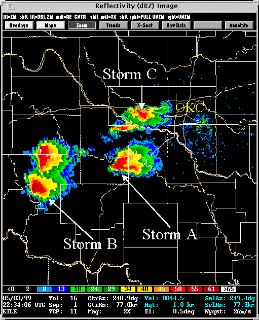
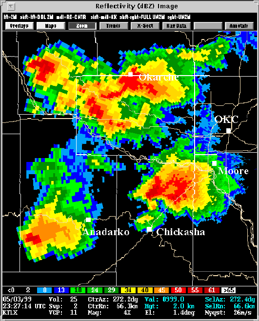
Storm A was tornadic during all of its roughly four hour lifetime. The first was a narrow but strong tornado near Stecker. The tornadoes became larger and stronger as this storm evolved toward Oklahoma City. For the most part, WSR-88D data revealed a blatantly dangerous storm on which the NSSL algorithms performed well. Several of the more interesting radar products from Storm A are included below.
1.
THE
STECKER TORNADO:
Touching down in rural Southwest Oklahoma, the Stecker tornado was
the first significant tornado of the outbreak, as well as the first from
the long track supercell that struck Oklahoma City some two hours later.
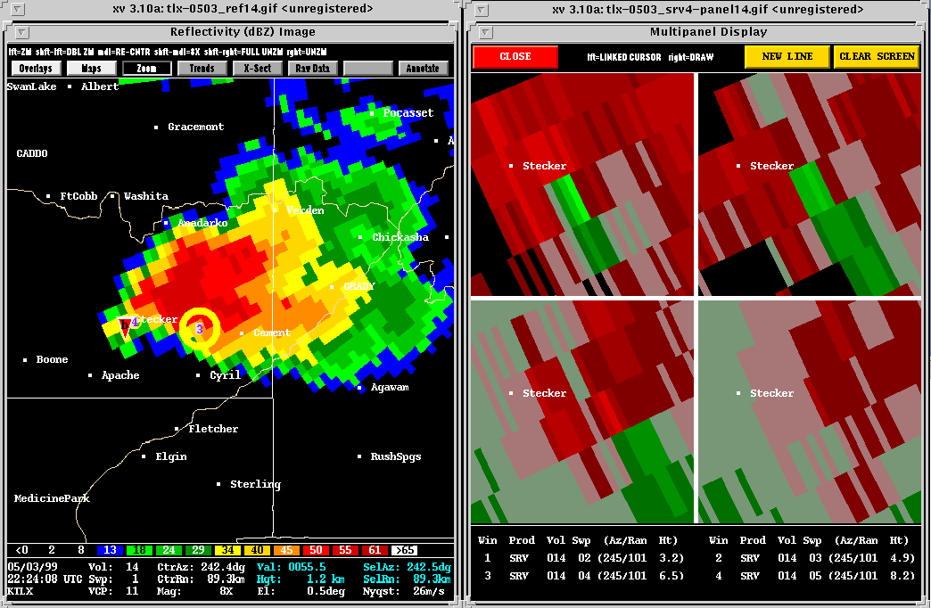
Description: This tornado
formed in an occluded, tightly rotating mesocyclone. The NSSL VORTEX crew
were among many chasers to witness the tornado. To observers, the
tornado appeared to become severely occluded, and detatched from a larger,
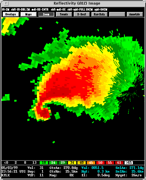
cyclonically rotating CB to its east. The MDA and BWER algorithms
detected both mesocyclones at (22:19).
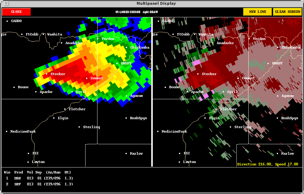
This two mesocyclone structure (one occluded and producing a tornado) becomes
more evident when looking at higher tilt reflectivity
and SRV.
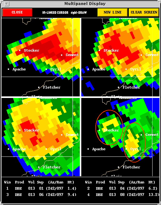
And near 13
kilometers,
Sweep 8 SRV reveals
a strongly divergent storm top signature.


The Stecker tornado lasted about 15 minutes, and did F3 damage to
this
home. Meanwhile, the larger mesocyclone
located farther east gained strength, and began its string of violent tornadoes.
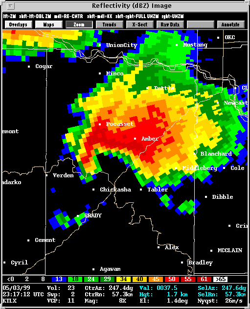
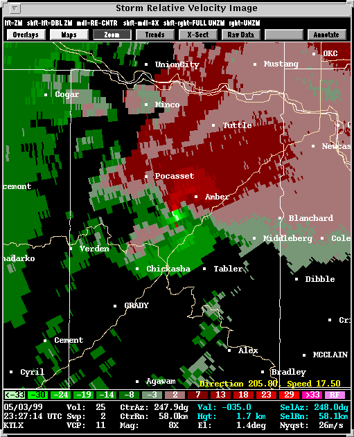
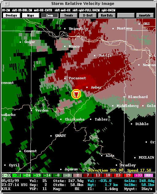
2. THE CHICKASHA TORNADO:
Description: By (22:34)
the outbreak began to take shape. Storm B, located
southwest of Anadarko, was producing the first of its 21 eventual tornadoes.
Storm
C, located south of Okarche, would produce tornadoes one hour later.
From a public warning standpoint, however, heavy emphasis was placed on
Storm A as it approached Chickasha. WSR-88D data depicted increasingly
well defined hook echos, mesocyclones,
and
tornado vortex signatures (TVS).
At one point, a satellite tornado formed around the main tornado, as seen
in this picture.
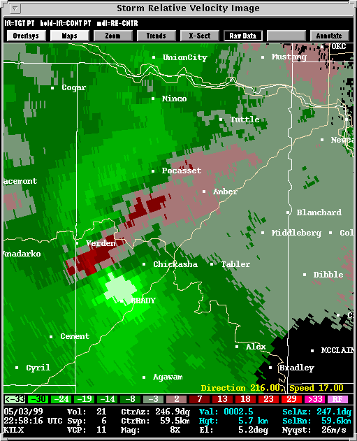
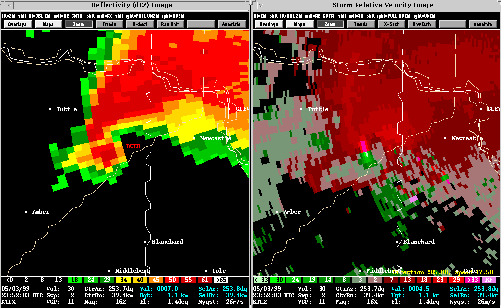
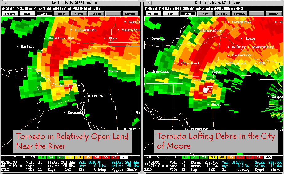
3. THE BRIDGE CREEK/MOORE/OKLAHOMA CITY TORNADO:
Description: Having done F3
damage to the airport on the northwest side of Chickasha, the Storm A went
through a rapid cycling phase. The next tornado formed to the northeast
of Chickasha, and would track 38 miles. Damage was rated as high as F5
in Bridge Creek and Moore as the tornado ripped through the Oklahoma City
metro area.
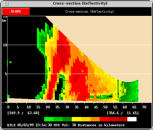
With a storm this strong being relatively close to the WSR-88D, its tornadic character was quite obvious in the data, such as at (23:51). It was at this time that the storm exhibited an incredible BWER, and a time-height trend taken from (00:12) captures some sense of mesocyclone strength as seen by the WSR-88D.
If the NSSL algorithms had any difficulty with this storm it happened when the storm was very near the radar... (00:42), for example. At this time, the long-lived mesocyclone had finally diminished or was weakening rapidly. The TVS signature that remained was associated with the weakening tornado. The feature is too small to meet the MDA's gate and depth requirements for a mesocyclone.
Overall, though, the MDA identified 35 of 42 possible mesocyclones (defined by the number of volume scans with human defined mesocyclones) directly related to the tornadoes of Storm A.
![]()