INTRODUCTION
As we continue to dig into the SWAT-V case database, we discover a spectrum of supercell and tornado events. Presented here are some intruiging storms that occurred near Portland, Oregon, on October 3, 1998. Two tornadoes were reported from two individual storms. One produced some minor damage. WSR-88D data depicts lowtopped storms with a significant lean in the vertical, and modest rotation. These low-topped, mini-supercells can occur anywhere under the right conditions (e.g. low equilibrium level, adequate shear, and instability). The SWAT-V case study page conatains examples of low-topped, mini-supercells from West Virginia, California, Arizona, Oklahoma, and now Oregon and Washington.
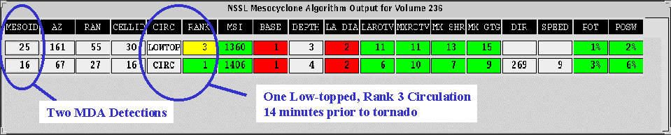
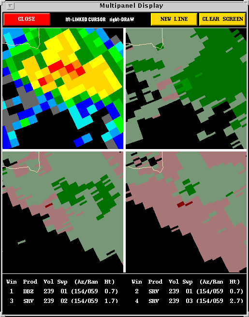
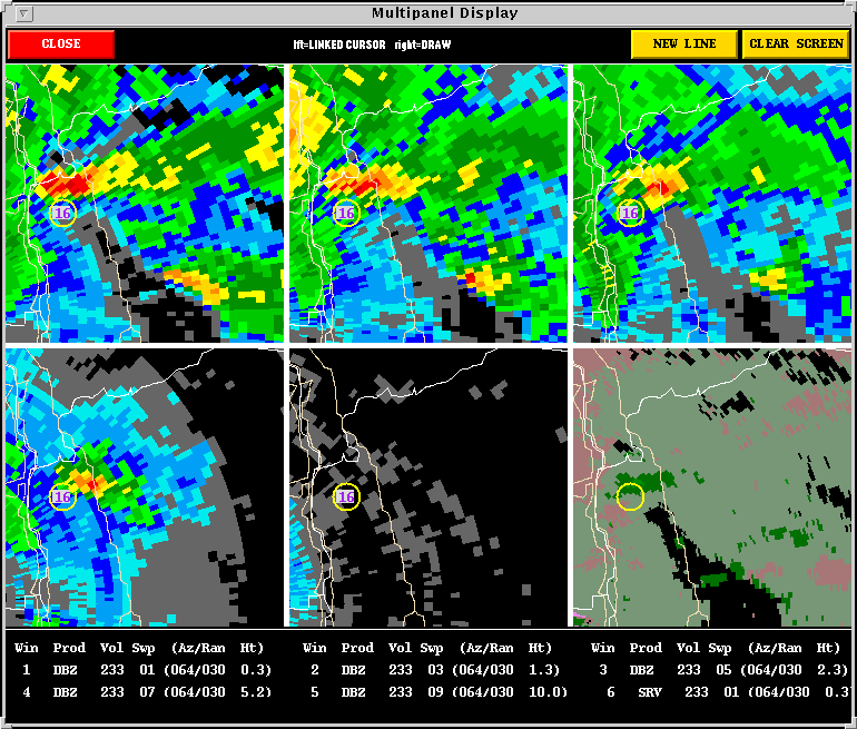
The NSSL Mesocyclone
Detection Algorithm (MDA) and Tornado
Detection Algorithm (TDA) have been run on this case in a research
mode. This page presents some algorithm output as well as a radar overview
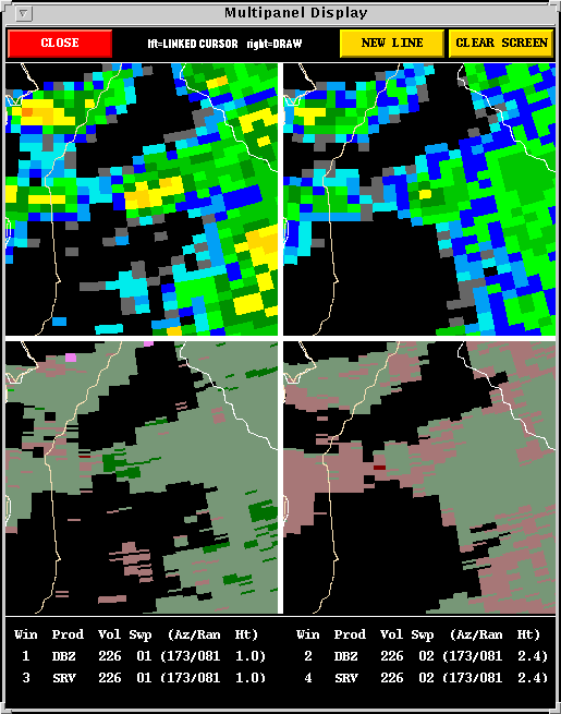
of the storms. A cyan circle represents a 2D vortex feature (from
a constant elevation angle) as detected by the MDA. Yellow, and red-in-yellow
circles represent 3D vortex detections.
The Tornadic Storms:
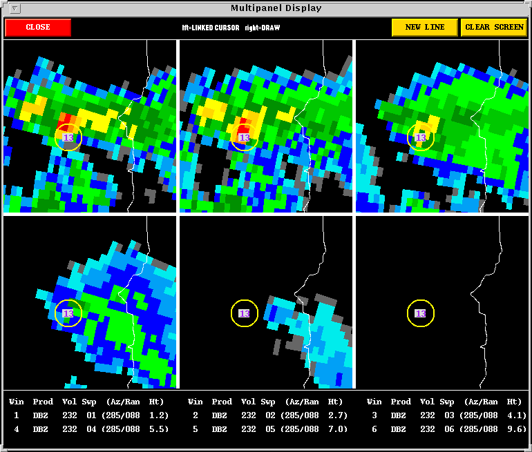
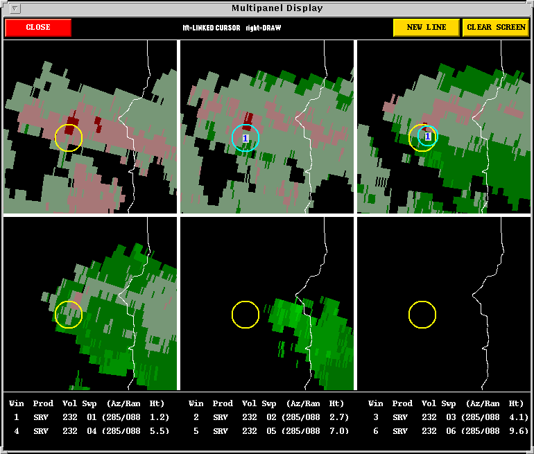
The second storm occurred south of Portland,
Oregon, producing a brief tornado around 23:45
UTC. The MDA identified a Rank 3 circulation within this storm
at 23:31 UTC. The storm appeared
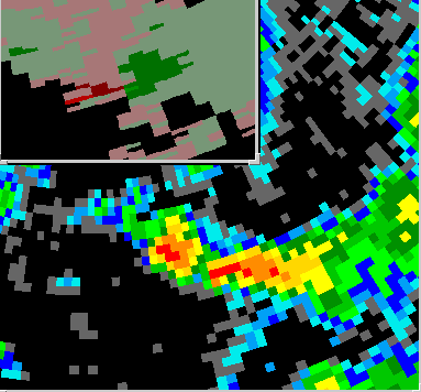
somewhat less impressive on radar when it produced the tornado. However,
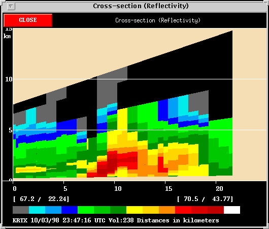
base scan reflectivity revealed a miniature weak echo region, and the base
scan velocity image showed a 15 m/s gate to gate velocity difference.
The storm was low-topped, miniature, and is a borderline supercell.
It showed sustained organization for a little over one hour.
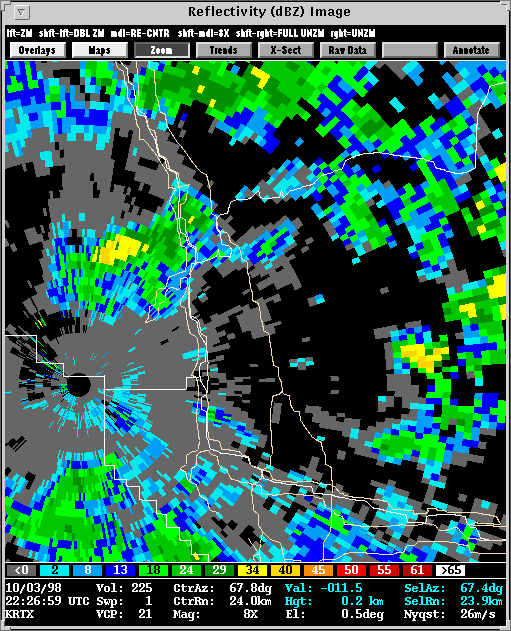
A Marine Storm:
Description: This storm may have produced severe weather, but it weakened just as it came onshore. The storm existed on radar for at least one hour.An Impressive Storm in Washington
The radar presentation of the storm is quite impressive. The
Washington storm can certainly be called a low-topped, mini-supercell.
Some perspective may be gained by comparing it to other supercells.
The Washington storm is not as small as one that took place near Phoenix
in 1995. It is many times smaller, however, than some of the large
supercells that occur more frequently east of the Rockies. The end
result is the same, to a degree, a thunderstorm capable of producing damage
regardless of location.
![]()