On May 4 1998, a rare pair of tornadoes touched down in the San Francisco Bay area near the city of Sunnyvale. Both tornadoes cuased F1 to weak F2 damage. The tornadoes occurred from a left-moving anticyclonically-rotating low-topped supercell. The tornadoes were each reported to be rotating anti-cyclonically (clockwise) as well, making for an extremely rare event. To our knowledge, this is the only documented case of a tornadic anti-mesocyclone in the United States that has been captured with WSR-88D Level-II data.
The near-storm enviroment of the day was characterized by an anticyclonically curved hodograph, and moderate instability. For more information on the storm's environment, consult this excellent summary Web page developed by Dr. John Monteverdi of the San Francisco State University.
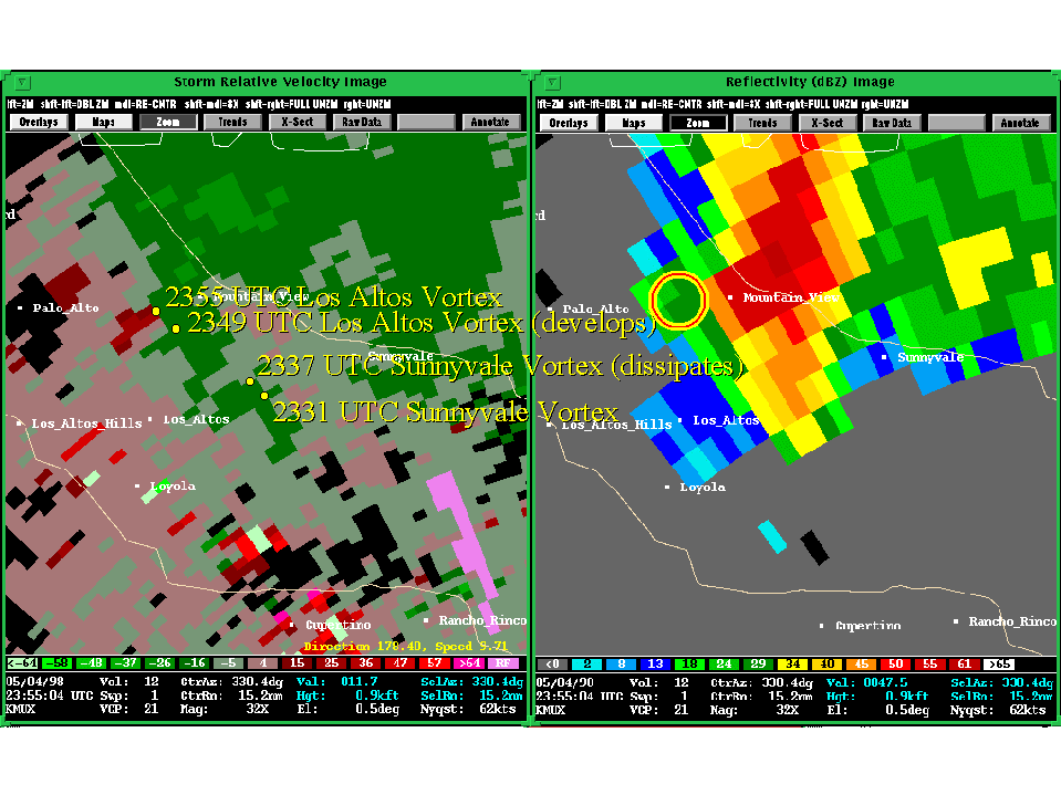
Presented here are various WSR-88D radar images from the Monterey, California (KMUX) radar. Included in some of the images is output from NSSL's Mesocyclone Detection Algorithm (MDA). A cyan circle represents a 2D vortex feature (from a constant elevation angle) as detected by the MDA. Yellow, and red-in-yellow circles represent 3D vortex detections. However, that is unique about this case is that the overlays are of anti-mesocyclones!
We have done a similar thing (but this time flipped north and south) with this case of a left (equatorward) moving cyclonic supercell near Sydney Australia (the hailstorm of 14 April 1999). Note that in this case, the supercell is a classic supercell comon to the Southern Hemisphere, and not an anticyclonic storm moving poleward as in the Sunnyvale case.
Unfortunately, this is the first volume scan on the Level-II archive
tape, and it is unknown from these data the origins of rotation in the
tornado. The fact that the vortex is more apparent a few elevation
scans above the 0.5° tilt might be an indication that this tornado
was from a descending vortex.
Finally: Putting these storms in perspective, we can look at another case of a similar looking supercell, one which is left-turning, rotating clockwise, and has a hook on its left side. However, this storm is a classic cyclonic supercell in the Southern Hemisphere, the Sydney hailstorm of 14 April 1999.
Back
to NSSL SWAT Case Study Table of Contents Page.