Repeatedly during the spring of 1998 the Southeast U.S. experienced very dynamical severe weather and tornado events. On April 8th one particularly dangerous supercell was responsible for producing three very strong to violent tornadoes, making a profound human impact in North Central Alabama. The second in the series of tornadoes killed 32 people along its 30.6 mile track. According to the American Red Cross, there were 1164 families whose homes were either destroyed or made unlivable (Storm Data). Ironically, the situation could have been made considerably worse had the tornado not lifted when it did. Had the tornado remained on the ground for only four more miles its trajectory would have taken it into the high rise buildings of downtown Birmingham and eventually into that city's airport.
As one might expect, the Birmingham supercell displayed many of the radar signatures that are more frequently associated with tornadic thunderstorms.
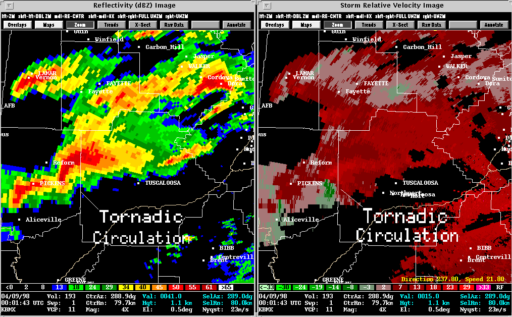
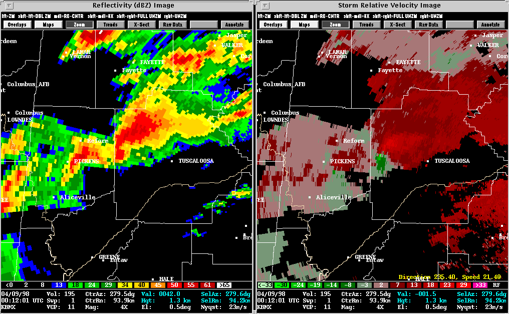
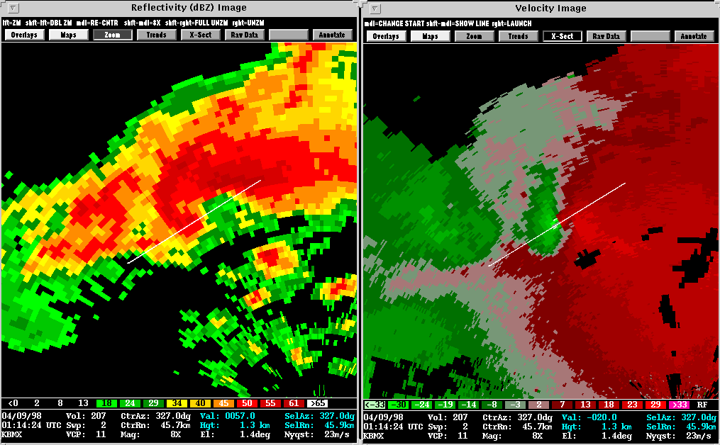
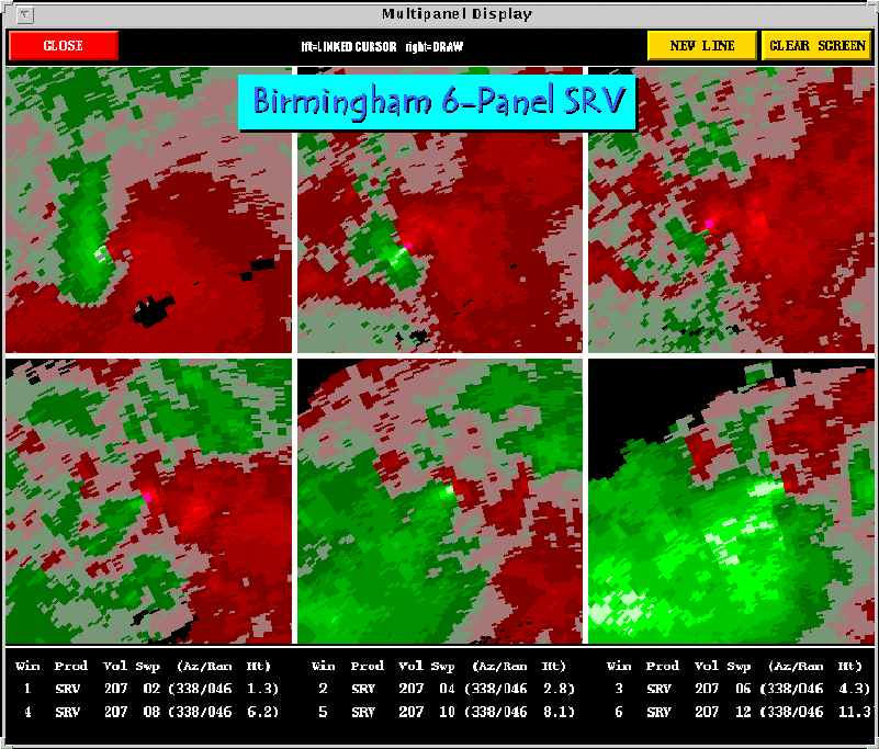
Presented here are various WSR-88D radar images from the Birminham, Alabama (KBMX) radar. Included in some of the images is output from NSSL's Mesocyclone Detection Algorithm (MDA) and Tornado Detection Algorithm (TDA). A yellow circle represents a mesocyclone as detected by the MDA. The red-in-yellow circle represents a mesocyclone whose base is at the lowest radar scan (where it is a more likely tornado threat). A red triangle depicts a Tornado Vortex Signature (TVS) as detected by the NSSL TDA.
By 0058 UTC, the Birmingham supercell was unfurling its peak intensity as it approached the city's suburbs. It was around this time that the storm echoed back its most impressive radar signatures. Warnings were issued well in advance of the storm's arrival, but, unfortunately, the most violent of tornadoes are difficult to survive without the aid of underground shelter. It is important to remember, though, that such violent tornadoes are very rare and affect isolated locations.
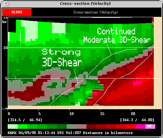
The Birmingham circulation leans downwind toward the east. The lean may be partly attributed to having the storm translate eastward inbetween each elevation scan of the radar. The main contributing factor, though, is strong vertical wind shear in the large scale environment.
For comparison, the Jarell Cross Section represents an environment with very little vertical wind shear. Yet, this storm, too, produced a devastating tornado. How this can occur may depend on several factors, and remains a key research topic. This storm was not as close to the nearest radar as the Birmingham storm, so nothing can be inferred about the strength of the circulation in the lowest levels. The depth of the two storms' circulations, however is comparable, about 10 km. The Jarrell storm is standing straight up in its low wind shear environment.
Furthermore, compare these storms with a Dozier Cross Section. The tornadic circulation near Dozier, TX (Case Study - June 11, 1997), has a depth of only 2.5 km. This, in spite of having formed in the Texas Panhandle which is much higher above sea level than the previous two cases. The Dozier tornado's east-west lean is not a product of wind shear in the large scale environment; it is a product of rain-cooled outflow undercutting the circulation. The tornado was relatively much weaker than those at Birmingham and Jarrell, but it was able to sustain itself for about six minutes.
These are only a few of the countless different types of tornadic circulations being sampled by WSR-88Ds. The Birmingham tornado represents a storm in a highly sheared, unstable environment. This storm displayed many of the radar signatures more frequently associated with tornadic thunderstorms. Examples of other types of tornadic storms can be found by exploring the many cases presented on SWAT's case study page.
![]()
Birmingham
Case Summary (from the Birmingham NWSFO)
SWAT
Case Study - Dozier, TX, June 11, 1997
Back
to NSSL SWAT Case Study Table of Contents Page.