
Tropical mesocyclones present a challenge to algorithms because they are especially shallow. Circulations are often detectable only on the lowest elevation scan of the radar, and some appear deceivingly weak. Some of the Hurricane Bertha mesocyclones appeared relatively weak but still managed to produce tornadoes. In addition, tropical mesocyclones can develop very quickly, allowing little room for error. These kinds of mesocyclones are also rare, only occurring with landfalling tropical systems. We simply do not have a large enough data base of these types of vortices to fully understand them.
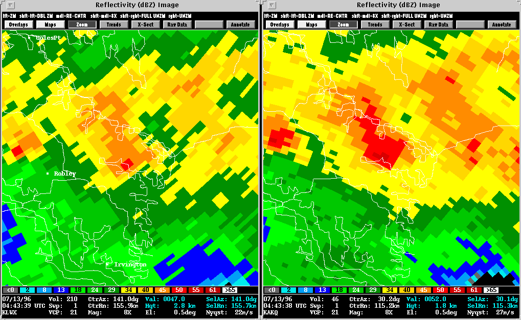
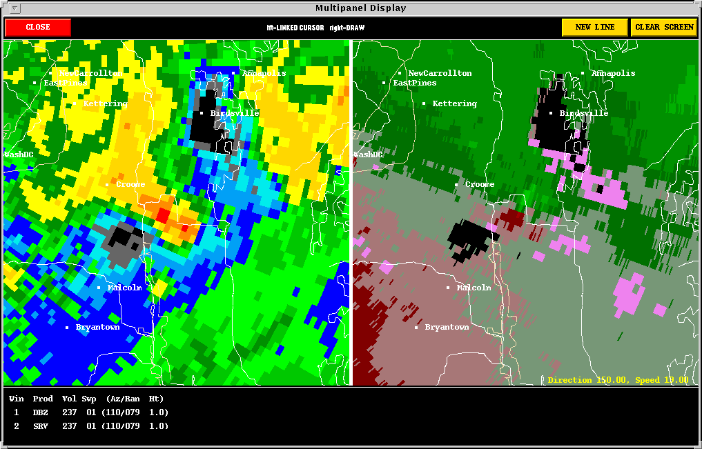
Presented here are various WSR-88D radar images from the Wakefield, VA radar (KAKQ) and the Sterling, VA radar (KLWX). Included in some of the WSR-88D images is output from NSSL's Mesocyclone Detection Algorithm (MDA). A yellow circle depicts a mesocyclone. The red-in-yellow circle depicts a mesocyclone whose base is at the lowest radar scan (where it is a more likely tornado threat).
TROPICAL MESOCYCLONES (KAKQ Loops)
RADAR COMPARISON (Both KLWX and KAKQ radars viewed this storm)
The applied research community is increasingly becoming aware that the integration of radar data from more than one radar (WSR-88D and media radars as well!), will be necessary to reduce some of the uncertainties inherent in viewing storms from only one angle and distance. There are a variety of limitations of Doppler radar, and if two or more radars are viewing a storm, you decrease the chance that the multiple radars are each limiting the view of a single point in space. Watch for more examples on these pages in the future!
(KAKQ) IMAGES
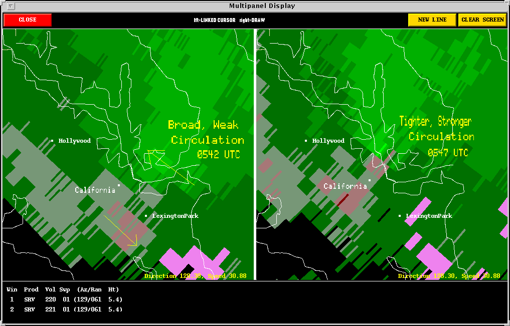
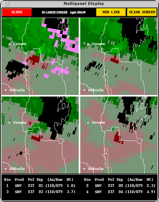
The second Panel follows the mesocyclone from pre-tornado to tornado; the frames are 10 minutes apart. One can clearly see the mesocyclone spin up tighter at the time of the tornado.
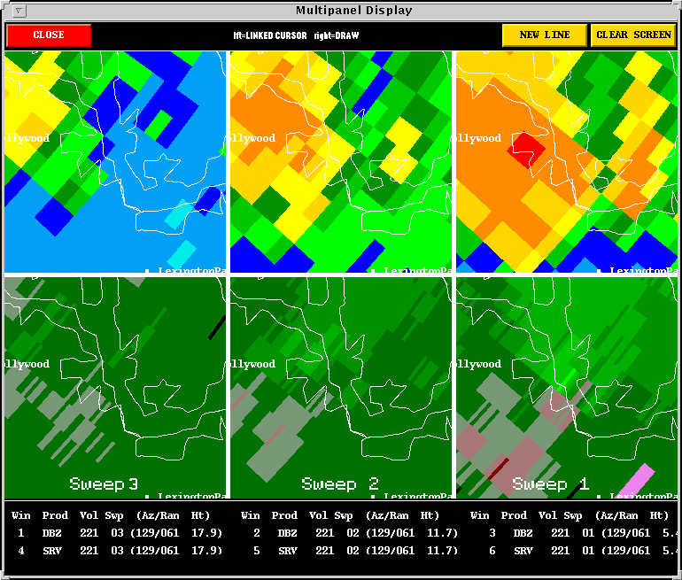
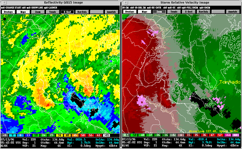
The third Panel shows reflectivity alongside the corresponding velocity data for the time of the tornado. The tornado is at the comma head where convergence and storm updrafts are taking place. The comma head is nicely reflected in the velocity data.
The storms are moving to the northwest, so the RFD, which is typically aligned northeast to southwest in a northeastward moving supercell, is instead aligned northwest to southeast. However, the same principles for tornado formation apply. The reference frame is simply rotated 90 degrees clockwise. The supercells assocaited with Hurricane Opal had a similar orientation.
The Loop image follows two mesocyclones, the first of which is the Yorktown mesocyclone. It moves across the center of the screen. The second mesocyclone appears offshore in the Atlantic and is actually quite strong for a time. Fortunately, the mesocyclone weakens before moving onshore near Severn, but it still produced minor tornado damage.
The Cross Section images, when viewed sequentially, again illustrate
the rapid development of this tornadic circulation . Note that the
circulation originated at storm base.
(KLWX) IMAGES
The Loop presents an interesting side
by side look at reflectivity and storm relative velocity in motion.
The California, MD, storm went on to produce another brief tornado near
Hughesville. The storm was tracking just to the northeast of Bertha's
center of circulation which is evidenced by the curved line of storms on
the left side of the loop images.
Back to NSSL SWAT Case Study Table of Contents Page.