
NSSL SWAT Case Study - 22 June 1996 Eastern Michigan
Numerous supercells formed north of Detroit, MI. Driven by the
northwest flow aloft, the storms trained southeasterly along a stalled
surface front. The late evening event produced notable severe weather
including at least three tornadoes. This is another of the many cases
from around the country which NSSL is using to test its Mesocyclone
Detection Algorithm (MDA).
Presented here are various WSR-88D radar images from the Detroit, MI
radar (KDTX). Included in some of the images is output from NSSL's
Mesocyclone Detection Algorithm (MDA). A yellow circle depicts a mesocyclone.
A red-in-yellow circle indicates the mesocyclone extends to the lowest
elevation scan of the radar (extists near or ar the base of the storm)
where it is a more likely tornado threat.
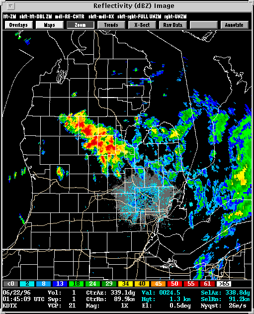
Description: The storm overview, constructed using hourly intervals,
shows supercells training along the stalled surface front. Several
of the storms exhibited mesocyclones, and one storm produced F3 tornado
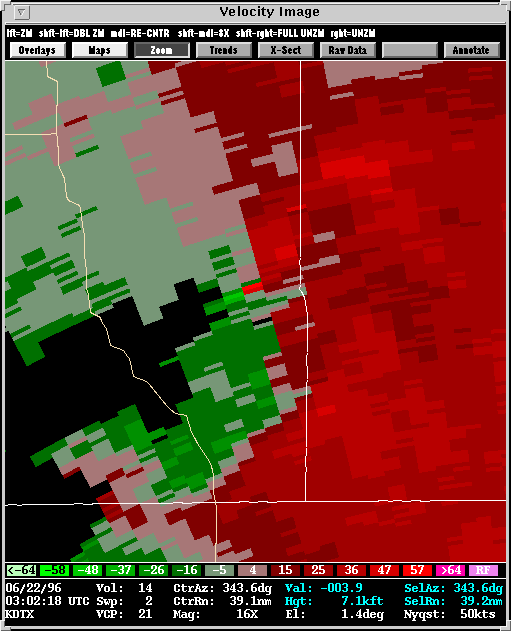
damage near the town of Frankenmuth. The tornado shows up in the velocity
frame as one bright red pixel adjacent to a bright green pixel.
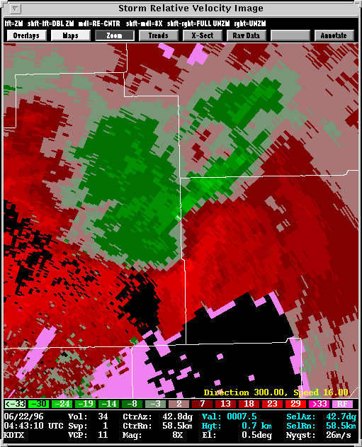
Description: This frame depicts a tornado on the border of Lapeer
and St. Clair counties. The storm relative velocity signature is quite
impressive. The tornado is near the bright green pixel on the county line.
The red indicates inflow. The green area south of the tornado is a rear
flank downdraft(RFD) helping to spin up the tornado, and the curved boundary
between the RFD. The red inflow is the RFD gustfront which curls
into the tornado. An RFD gust front is somewhat analogous to a synoptic
scale cold front, the tornado being the low pressure center in this case.
Back to
NSSL SWAT Case Study Table of Contents Page.