![]()
One single isolated supercell occurred in the northeast Texas Panhandle near Miami TX on this day. The supercell produced one F1 tornado over open country. The supercell updraft was visible for many miles as a scuplted "barberpole" style updraft, thus leading many to characterize the storm as an LP supercell. As you will see, the storm did not always appear to be LP in nature.
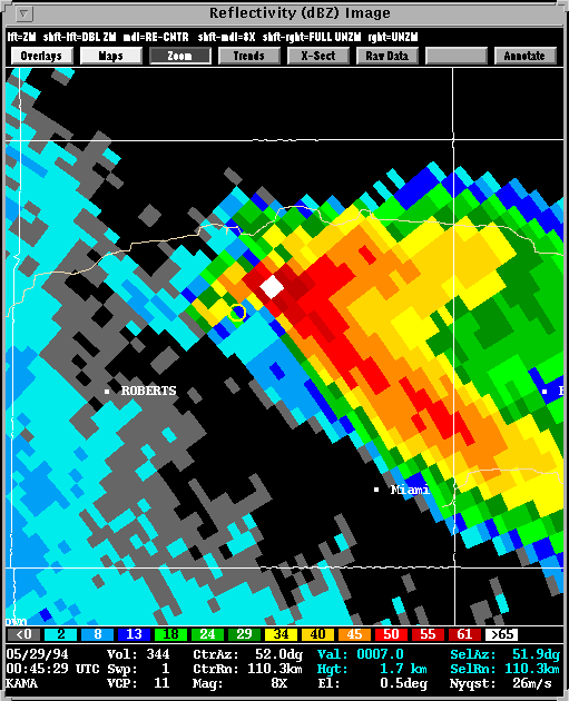
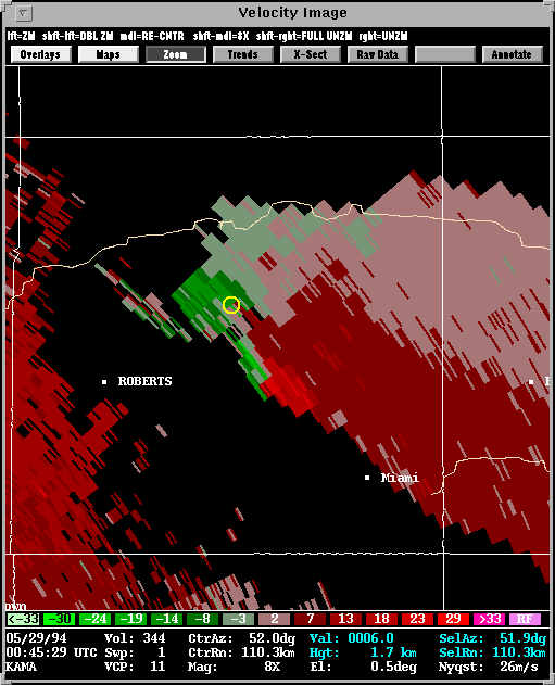
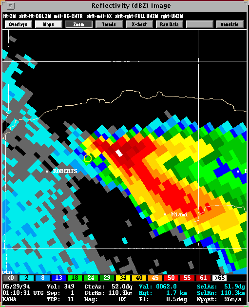
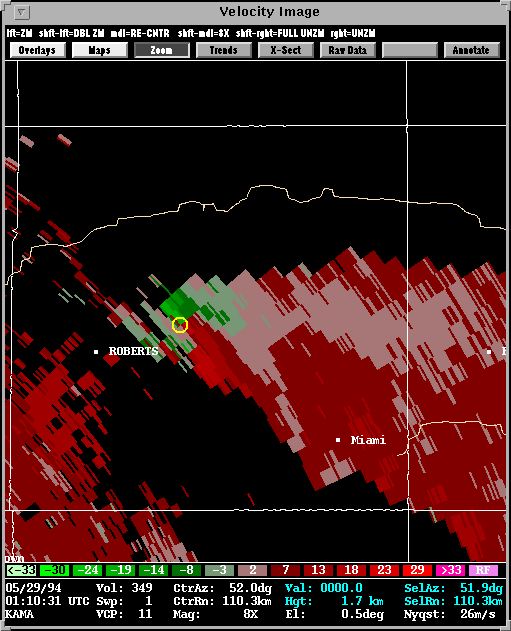
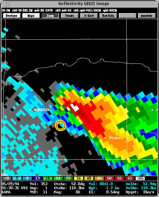
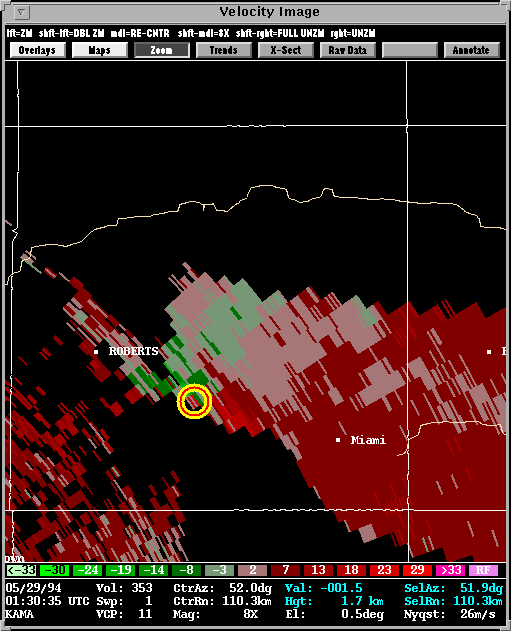
Presented here are various WSR-88D radar images from the Amarillo, TX radar (KAMA). Included in some of the images is output from NSSL's Mesocyclone Detection Algorithm (MDA). A yellow circle depicts a mesocyclone. A red-in-yellow circle indicates the mesocyclone extends to the lowest elevation scan of the radar (exists near or at the base of the storm) where it is a more likely tornado threat.
There is clearly a thin hook wrapping around the back side of the low-level mesocyclone. Note that the beam is 1.7 km AGL, which is very near cloud base. Some visual obsrvations claimed that the LL meso did not have a visual hook of precipitation. Clearly, from this radar vantage point, there is a hook. This is probably not an LP supercell at this time.
The hook appears to be thinner, but the low-level mesocyclone is still very close to the forward flank updraft. We would hesitate to call this an LP supercell at the time of the tornado.
Now...things have changed! A new low-level mesocyclone has developed south and east from the previosly-, and now dissipated tornadic low-level mesocyclone. It is clearly separated from the forward flank core, and this supercell now has LP characteristics. Note on the 8-panel display (showing data at 1.6, 3.4, 5.2, and 6.9 km AGL), that there is a significant echo overhang, which can be visualized by the placement of the mesocyclone detection algorithm icon (the red-in-yellow circle) that is located at the location of the low-level mesocyclone.
Learn more about this event on Mike Kay's Page.
Learn more about this event on John Montiverde's Page.
Back to
NSSL SWAT Case Study Table of Contents Page.