Links to Four Image Sets:
1. Topographic Maps
2. Total Lightning Strikes
3. Total Storm Days
4. Light. vs Elev. Plot
1. Topographic Maps
2. Total Lightning Strikes
3. Total Storm Days
4. Light. vs Elev. Plot
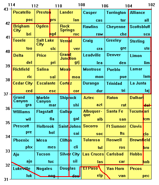
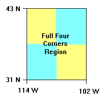
The region of study includes rectangular sector that runs from latitude 31 deg. N to 43 deg. N and from longitude 102 deg. W to 114 deg. W. This area consists of 72 (6 across by 12 high) different 1 deg. latitude by 2 deg. longitude USGS quadrangles. A complete listing of these quads is given in a graphic below. The full name of the USGS quad is shown in the upper left hand corner of the boxes, while a unique three letter abbrieviation (usually, but not always the first three letters in the full name) is given in the lower right hand corner, that is used to refer to these quads in these pages.
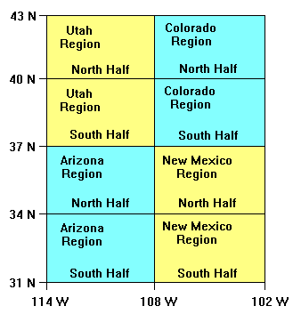
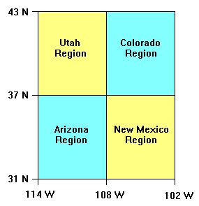
The full region will also be divided into four quarters (each 3 quads wide and 6 quads tall). These four sub-sections roughly correspond to the four states of Arizona, Colorado, New Mexico and Utah and will be referred to as the 'Arizona Region', the 'Colorado Region', and so on. The actual state boundaries are shown below in red. It can be seen, for instance, that the Colorado Region contains a fairly large slice of Wyoming and Nebraska as well.
The graphic below also provides links to topographic maps and lightning maps for each individual quad.
Click on the quad below to go to the corresponding maps:
This graphic offers links to the same 72 quad region except that the maps cover larger areas. The region has been split into eight sub-sections consisting of 3 quad by 6 quad rectangles.
Click on the region below to go to the corresponding maps:
This graphic offers links to the same 72 quad region except that the maps cover even larger areas. The region has been split into fourt sub-sections consisting of 6 quad by 6 quad rectangles.
Click on the region below to go to the corresponding maps:
This graphic offers links to maps for the full 72 quad region.
Click on the region below to go to the corresponding maps:
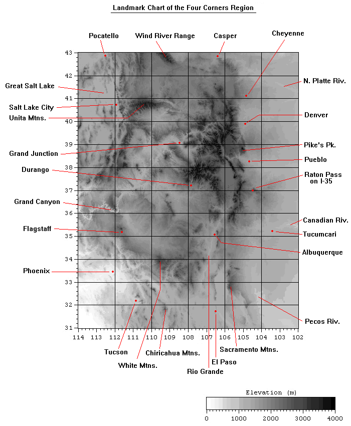
The following is a topographic map of the full 72 quad. region of interest. It is gridded with quad lines and can be used to help locate the quad where a specific valley, city or mountain range is found.