
The Intermountain Precipitation
Experiment
Images from the Doppler on Wheels
The Intermountain Precipitation
Experiment
Images from the Doppler on Wheels
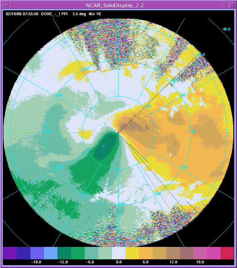
animation of velocity PPIs of mesoscale shear line (1955-1957 UTC)
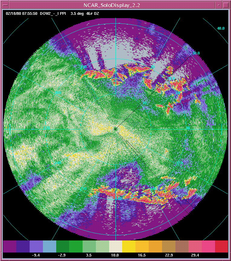
animation of reflectivity PPIs of mesoscale shear line (1955-1957 UTC)
Above are several images from 2/17. After ~1800, the DOWs were operating in the Tooele Valley, several km east of Grantsville, on Erda Way Rd. (near Hwy 138). The truck was pointed at 90 deg (so, all images must be rotated 90 deg). The RHIs, ~20:19 UTC, show some waves in the velocity field. These are also depicted in PPIs at 3.5 deg (in the PPIs, 90 deg is true north, as implied in the previous statement). Don't have an explanation for this yet.
At ~2041 UTC, and in fact even earlier, there's a curious feature S. of the radar -- in the attached 3.5deg PPI, the feature appears as a cyclonic eddy, of diameter ~10 km; in lower tilts, the feature is more of a cyclonic shear zone than vortex. It's possible to visually associate some enhanced reflectivity with the "feature", although I'm unsure of any cause and effect.
Light snow to moderate snow was observed most of the time we were operating.
In all these images, 360 deg is west, 180 deg is east. Hence, the clutter in the reflectivity at the top of the image shows the Stansbury Mtns, and that at the bottom of the image, the Oquirrh Mtns.